Ossarn geodata
Ossarn (Lower Austria) is a populated place; located in Austria in Europe/Vienna (GMT+2) time zone. With population of 782 people, there are 1652 cities with bigger population in this country. Compared to other cities in Austria, 83.8% of cities are located further ↓South; 72.5% of cities are located further ←West and 82.4% of cities have higher elevation than Ossarn. Note1
Administrative division(s):
- Level 1: Lower Austria
- Level 2: Politischer Bezirk Sankt Pölten
- Level 3: Herzogenburg


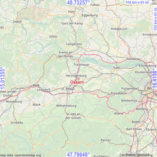
Ossarn GPS coordinates[2]
48° 16' 0.012" North, 15° 43' 0.012" East
| Map corner | latitude | longitude |
|---|---|---|
| Upper-left | 48.73257°, | 15.01355° |
| Center: | 48.26667°, | 15.71667° |
| Lower-right: | 47.79648°, | 16.4198° |
| Map W x H: | 104.1×104.1 km | = 64.7×64.7mi |
| max Lat: | 48.98333° ⇑16.2% North |
| Ossarn: | 48.26667° |
| min Lat: | ⇓83.8% South 46.48841° |
| min Long | Ossarn | max Long |
| 9.57802° | 15.71667° | 17.1° |
| W 72.5%⇐ | ⇒27.5% E |
Elevation
Elevation of Ossarn is 263 m = 863 ft, and this is 242.5 m = 796 ft below average elevation for this country.
| Max E: |
2140 m = 7021 ft | 82.4% |
| Avg. | 505.5 m = 1658 ft | |
| Ossarn | 263 m = 863 ft | |
Min E: |
118 m = 387 ft | 17.6% |
See also: Austria elevation on elevation.city.
Geographical zone
Ossarn is located in North temperate zone (between Tropic of Cancer and the Arctic Circle). Distance of this North polar circle is 2034.4 km =1264.1 mi to North.| Distance of | km | miles | from Ossarn |
|---|---|---|---|
| North Pole | 4640.3 | 2883.3 | to North |
| Arctic Circle | 2034.4 | 1264.1 | to North |
| Tropic Cancer | 2760.8 | 1715.5 | to South |
| Equator | 5366.8 | 3334.8 | to South |


Nearby cities:
15 places around Ossarn: (largest is in red/bold)
• Böheimkirchen
8.4 km =5.2 mi,  156°
156°
• Etzersdorf
2.5 km =1.6 mi,  90°
90°
• Getzersdorf
7 km =4.3 mi,  347°
347°
• Herzogenburg
2.3 km =1.4 mi,  314°
314°
• Inzersdorf ob der Traisen
6.8 km =4.2 mi,  323°
323°
• Kapelln
3.2 km =2 mi,  107°
107°
• Oberndorf in der Ebene
2 km =1.2 mi,  281°
281°
• Pottenbrunn
3.9 km =2.4 mi,  198°
198°
• Ragelsdorf
6.6 km =4.1 mi,  243°
243°
• Ratzersdorf an der Traisen
5.8 km =3.6 mi,  219°
219°
• Reichersdorf
8 km =5 mi, 350°
• Sankt Andrä an der Traisen
3.4 km =2.1 mi,  0°
0°
• Statzendorf
7.2 km =4.5 mi, 309°
• Unterradlberg
3.2 km =2 mi, 242°
• Unterwagram
7.8 km =4.8 mi, 219°
Sources, notices
• [Note1] Compared only with cities in Austria existing in our database
• [Src1] Map data: © OpenStreetMap contributors (CC-BY-SA)
• [Src2] Other city data from geonames.org with taken over terms of usage.
• [Src3] Geographical zone / Annual Mean Temperature by Robert A. Rohde @ Wikipedia
