Statzendorf geodata
Statzendorf (Lower Austria) is a seat of a third-order administrative division; located in Austria in Europe/Vienna (GMT+2) time zone. With population of 299 people, there are 2741 cities with bigger population in this country. Compared to other cities in Austria, 86.2% of cities are located further ↓South; 70.3% of cities are located further ←West and 78% of cities have higher elevation than Statzendorf. Note1
Administrative division(s):
- Level 1: Lower Austria
- Level 2: Politischer Bezirk Sankt Pölten
- Level 3: Statzendorf


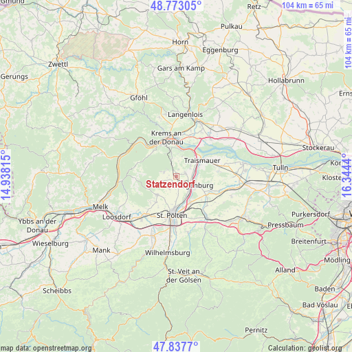
Statzendorf GPS coordinates[2]
48° 18' 27.072" North, 15° 38' 28.572" East
| Map corner | latitude | longitude |
|---|---|---|
| Upper-left | 48.77305°, | 14.93815° |
| Center: | 48.30752°, | 15.64127° |
| Lower-right: | 47.8377°, | 16.3444° |
| Map W x H: | 104×104 km | = 64.6×64.6mi |
| max Lat: | 48.98333° ⇑13.8% North |
| Statzendorf: | 48.30752° |
| min Lat: | ⇓86.2% South 46.48841° |
| min Long | Statzendorf | max Long |
| 9.57802° | 15.64127° | 17.1° |
| W 70.3%⇐ | ⇒29.7% E |
Elevation
Elevation of Statzendorf is 284 m = 932 ft, and this is 221.5 m = 727 ft below average elevation for this country.
| Max E: |
2140 m = 7021 ft | 78% |
| Avg. | 505.5 m = 1658 ft | |
| Statzendorf | 284 m = 932 ft | |
Min E: |
118 m = 387 ft | 22% |
See also: Austria elevation on elevation.city.
Geographical zone
Statzendorf is located in North temperate zone (between Tropic of Cancer and the Arctic Circle). Distance of this North polar circle is 2029.9 km =1261.3 mi to North.| Distance of | km | miles | from Statzendorf |
|---|---|---|---|
| North Pole | 4635.8 | 2880.6 | to North |
| Arctic Circle | 2029.9 | 1261.3 | to North |
| Tropic Cancer | 2765.4 | 1718.3 | to South |
| Equator | 5371.3 | 3337.6 | to South |


Nearby cities:
15 places around Statzendorf: (largest is in red/bold)
• Furth bei Göttweig
7.6 km =4.7 mi,  344°
344°
• Getzersdorf
4.6 km =2.9 mi,  60°
60°
• Herzogenburg
4.9 km =3 mi,  126°
126°
• Inzersdorf ob der Traisen
1.8 km =1.1 mi, 59°
• Karlstetten
7.8 km =4.8 mi,  226°
226°
• Nussdorf ob der Traisen
6.5 km =4 mi,  38°
38°
• Oberndorf in der Ebene
5.5 km =3.4 mi,  138°
138°
• Oberwölbling
3.8 km =2.4 mi,  286°
286°
• Ossarn
7.2 km =4.5 mi, 129°
• Paudorf
5.5 km =3.4 mi, 342°
• Ragelsdorf
7.5 km =4.7 mi,  183°
183°
• Reichersdorf
5.4 km =3.4 mi,  51°
51°
• Sankt Andrä an der Traisen
5.7 km =3.5 mi,  101°
101°
• Unterradlberg
6.6 km =4.1 mi,  155°
155°
• Wagram ob der Traisen
8 km =5 mi, 40°
Sources, notices
• [Note1] Compared only with cities in Austria existing in our database
• [Src1] Map data: © OpenStreetMap contributors (CC-BY-SA)
• [Src2] Other city data from geonames.org with taken over terms of usage.
• [Src3] Geographical zone / Annual Mean Temperature by Robert A. Rohde @ Wikipedia
