Pottenbrunn geodata
Pottenbrunn (Lower Austria) is a populated place; located in Austria in Europe/Vienna (GMT+2) time zone. With population of 2,390 people, there are 508 cities with bigger population in this country. Compared to other cities in Austria, 81.7% of cities are located further ↓South; 72.1% of cities are located further ←West and 84.7% of cities have higher elevation than Pottenbrunn. Note1


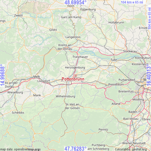
Pottenbrunn GPS coordinates[2]
48° 13' 59.988" North, 15° 42' 0" East
| Map corner | latitude | longitude |
|---|---|---|
| Upper-left | 48.69954°, | 14.99688° |
| Center: | 48.23333°, | 15.7° |
| Lower-right: | 47.76283°, | 16.40313° |
| Map W x H: | 104.2×104.1 km | = 64.7×64.7mi |
| max Lat: | 48.98333° ⇑18.3% North |
| Pottenbrunn: | 48.23333° |
| min Lat: | ⇓81.7% South 46.48841° |
| min Long | Pottenbrunn | max Long |
| 9.57802° | 15.7° | 17.1° |
| W 72.1%⇐ | ⇒27.9% E |
Elevation
Elevation of Pottenbrunn is 248 m = 814 ft, and this is 257.5 m = 845 ft below average elevation for this country.
| Max E: |
2140 m = 7021 ft | 84.7% |
| Avg. | 505.5 m = 1658 ft | |
| Pottenbrunn | 248 m = 814 ft | |
Min E: |
118 m = 387 ft | 15.3% |
See also: Austria elevation on elevation.city.
Geographical zone
Pottenbrunn is located in North temperate zone (between Tropic of Cancer and the Arctic Circle). Distance of this North polar circle is 2038.1 km =1266.4 mi to North.| Distance of | km | miles | from Pottenbrunn |
|---|---|---|---|
| North Pole | 4644 | 2885.6 | to North |
| Arctic Circle | 2038.1 | 1266.4 | to North |
| Tropic Cancer | 2757.1 | 1713.2 | to South |
| Equator | 5363 | 3332.4 | to South |


Nearby cities:
15 places around Pottenbrunn: (largest is in red/bold)
• Böheimkirchen
6 km =3.7 mi,  130°
130°
• Etzersdorf
5.2 km =3.2 mi,  44°
44°
• Herzogenburg
5.4 km =3.4 mi,  355°
355°
• Kapelln
5.1 km =3.2 mi,  56°
56°
• Oberndorf in der Ebene
4.2 km =2.6 mi,  349°
349°
• Oberwagram
5.2 km =3.2 mi,  226°
226°
• Ossarn
3.9 km =2.4 mi,  18°
18°
• Ragelsdorf
4.8 km =3 mi,  279°
279°
• Ratzersdorf an der Traisen
2.6 km =1.6 mi,  252°
252°
• Sankt Andrä an der Traisen
7.2 km =4.5 mi,  10°
10°
• Sankt Pölten
6.2 km =3.9 mi, 233°
• Stattersdorf
7.4 km =4.6 mi,  221°
221°
• Unterradlberg
2.8 km =1.7 mi,  324°
324°
• Unterwagram
4.4 km =2.7 mi,  238°
238°
• Viehofen
6.4 km =4 mi, 253°
Sources, notices
• [Note1] Compared only with cities in Austria existing in our database
• [Src1] Map data: © OpenStreetMap contributors (CC-BY-SA)
• [Src2] Other city data from geonames.org with taken over terms of usage.
• [Src3] Geographical zone / Annual Mean Temperature by Robert A. Rohde @ Wikipedia
