Hochleithen geodata
Hochleithen (Lower Austria) is a seat of a third-order administrative division; located in Austria in Europe/Vienna (GMT+2) time zone. In our database, there are 2958 cities with bigger population. Compared to other cities in Austria, 92.9% of cities are located further ↓South; 94.6% of cities are located further ←West and 90.1% of cities have higher elevation than Hochleithen. Note1
Administrative division(s):
- Level 1: Lower Austria
- Level 2: Politischer Bezirk Mistelbach
- Level 3: Hochleithen


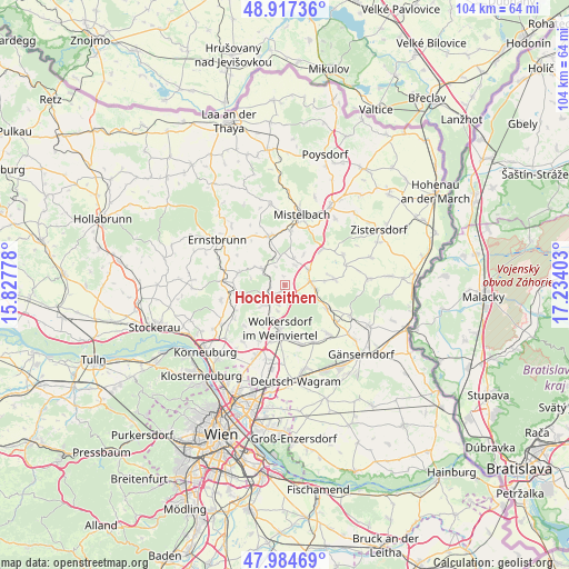
Hochleithen GPS coordinates[2]
48° 27' 11.412" North, 16° 31' 51.24" East
| Map corner | latitude | longitude |
|---|---|---|
| Upper-left | 48.91736°, | 15.82778° |
| Center: | 48.45317°, | 16.5309° |
| Lower-right: | 47.98469°, | 17.23403° |
| Map W x H: | 103.7×103.7 km | = 64.4×64.4mi |
| max Lat: | 48.98333° ⇑7.1% North |
| Hochleithen: | 48.45317° |
| min Lat: | ⇓92.9% South 46.48841° |
| min Long | Hochleithen | max Long |
| 9.57802° | 16.5309° | 17.1° |
| W 94.6%⇐ | ⇒5.4% E |
Elevation
Elevation of Hochleithen is 212 m = 696 ft, and this is 293.5 m = 963 ft below average elevation for this country.
| Max E: |
2140 m = 7021 ft | 90.1% |
| Avg. | 505.5 m = 1658 ft | |
| Hochleithen | 212 m = 696 ft | |
Min E: |
118 m = 387 ft | 9.9% |
See also: Austria elevation on elevation.city.
Geographical zone
Hochleithen is located in North temperate zone (between Tropic of Cancer and the Arctic Circle). Distance of this North polar circle is 2013.7 km =1251.3 mi to North.| Distance of | km | miles | from Hochleithen |
|---|---|---|---|
| North Pole | 4619.6 | 2870.5 | to North |
| Arctic Circle | 2013.7 | 1251.3 | to North |
| Tropic Cancer | 2781.6 | 1728.4 | to South |
| Equator | 5387.5 | 3347.6 | to South |


Nearby cities:
15 places around Hochleithen: (largest is in red/bold)
• Bad Pirawarth
5 km =3.1 mi,  91°
91°
• Gaweinstal
5.2 km =3.2 mi,  54°
54°
• Groß-Schweinbarth
8.6 km =5.3 mi,  119°
119°
• Großrußbach
8.8 km =5.5 mi,  285°
285°
• Hautzendorf
4.1 km =2.5 mi,  237°
237°
• Hohenruppersdorf
9 km =5.6 mi,  82°
82°
• Kreuzstetten
5.2 km =3.2 mi,  305°
305°
• Niederkreuzstetten
4.7 km =2.9 mi,  304°
304°
• Paasdorf
8.9 km =5.5 mi,  1°
1°
• Schleinbach
6.2 km =3.9 mi,  229°
229°
• Schrick
8.2 km =5.1 mi, 50°
• Ulrichskirchen
6.9 km =4.3 mi,  210°
210°
• Unterolberndorf
4.1 km =2.5 mi, 237°
• Wolfpassing an der Hochleithen
1.1 km =0.7 mi,  251°
251°
• Wolkersdorf im Weinviertel
7.8 km =4.8 mi,  187°
187°
Sources, notices
• [Note1] Compared only with cities in Austria existing in our database
• [Src1] Map data: © OpenStreetMap contributors (CC-BY-SA)
• [Src2] Other city data from geonames.org with taken over terms of usage.
• [Src3] Geographical zone / Annual Mean Temperature by Robert A. Rohde @ Wikipedia
