Grünburg geodata
Grünburg (Upper Austria) is a populated place; located in Austria in Europe/Vienna (GMT+2) time zone. With population of 3,824 people, there are 273 cities with bigger population in this country. Compared to other cities in Austria, 64.6% of cities are located further ↓South; 58.9% of cities are located further →East and 63.9% of cities have higher elevation than Grünburg. Note1
Administrative division(s):
- Level 1: Upper Austria
- Level 2: Politischer Bezirk Kirchdorf an der Krems
- Level 3: Grünburg


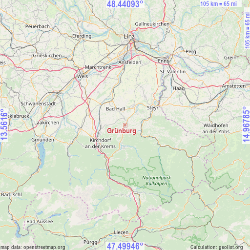
Grünburg GPS coordinates[2]
47° 58' 20.424" North, 14° 15' 52.992" East
| Map corner | latitude | longitude |
|---|---|---|
| Upper-left | 48.44093°, | 13.5616° |
| Center: | 47.97234°, | 14.26472° |
| Lower-right: | 47.49946°, | 14.96785° |
| Map W x H: | 104.7×104.7 km | = 65.1×65.1mi |
| max Lat: | 48.98333° ⇑35.4% North |
| Grünburg: | 47.97234° |
| min Lat: | ⇓64.6% South 46.48841° |
| min Long | Grünburg | max Long |
| 9.57802° | 14.26472° | 17.1° |
| W 41.1%⇐ | ⇒58.9% E |
Elevation
Elevation of Grünburg is 359 m = 1178 ft, and this is 146.5 m = 481 ft below average elevation for this country.
| Max E: |
2140 m = 7021 ft | 63.9% |
| Avg. | 505.5 m = 1658 ft | |
| Grünburg | 359 m = 1178 ft | |
Min E: |
118 m = 387 ft | 36.1% |
See also: Austria elevation on elevation.city.
Geographical zone
Grünburg is located in North temperate zone (between Tropic of Cancer and the Arctic Circle). Distance of this North polar circle is 2067.1 km =1284.4 mi to North.| Distance of | km | miles | from Grünburg |
|---|---|---|---|
| North Pole | 4673 | 2903.7 | to North |
| Arctic Circle | 2067.1 | 1284.4 | to North |
| Tropic Cancer | 2728.1 | 1695.2 | to South |
| Equator | 5334 | 3314.4 | to South |


Nearby cities:
15 places around Grünburg: (largest is in red/bold)
• Adlwang
4.2 km =2.6 mi,  302°
302°
• Aschach an der Steyr
6.9 km =4.3 mi,  49°
49°
• Bad Hall
8.5 km =5.3 mi,  329°
329°
• Feyregg
8.6 km =5.3 mi,  318°
318°
• Lahrndorf
8.9 km =5.5 mi,  73°
73°
• Leonstein
8.8 km =5.5 mi,  196°
196°
• Nussbach
7.5 km =4.7 mi,  270°
270°
• Obergrünburg
2.5 km =1.6 mi, 197°
• Pfarrkirchen bei Bad Hall
8.1 km =5 mi, 322°
• Sierning
8.6 km =5.3 mi,  22°
22°
• Steinbach an der Steyr
0.4 km =0.2 mi,  116°
116°
• Ternberg
7.6 km =4.7 mi,  113°
113°
• Untergrünburg
0.1 km =0.1 mi,  173°
173°
• Waldneukirchen
2.9 km =1.8 mi,  351°
351°
• Zehetner
1.7 km =1.1 mi,  152°
152°
Sources, notices
• [Note1] Compared only with cities in Austria existing in our database
• [Src1] Map data: © OpenStreetMap contributors (CC-BY-SA)
• [Src2] Other city data from geonames.org with taken over terms of usage.
• [Src3] Geographical zone / Annual Mean Temperature by Robert A. Rohde @ Wikipedia
