Feyregg geodata
Feyregg (Upper Austria) is a populated place; located in Austria in Europe/Vienna (GMT+2) time zone. With population of 844 people, there are 1530 cities with bigger population in this country. Compared to other cities in Austria, 68.4% of cities are located further ↓South; 60.8% of cities are located further →East and 59.5% of cities have higher elevation than Feyregg. Note1
Administrative division(s):
- Level 1: Upper Austria
- Level 2: Politischer Bezirk Steyr-Land
- Level 3: Pfarrkirchen bei Bad Hall


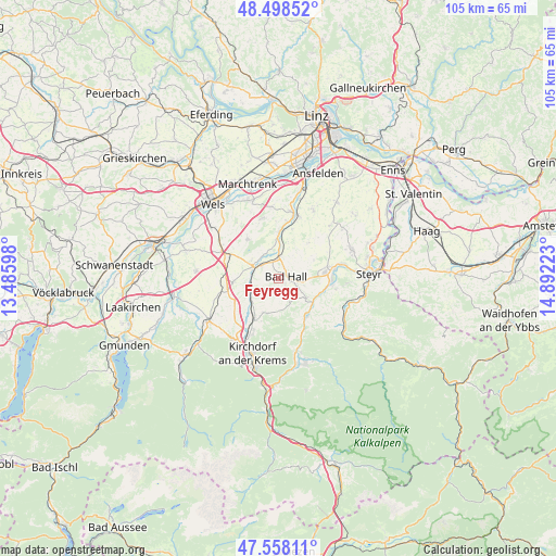
Feyregg GPS coordinates[2]
48° 1' 49.656" North, 14° 11' 20.76" East
| Map corner | latitude | longitude |
|---|---|---|
| Upper-left | 48.49852°, | 13.48598° |
| Center: | 48.03046°, | 14.1891° |
| Lower-right: | 47.55811°, | 14.89223° |
| Map W x H: | 104.6×104.6 km | = 65×65mi |
| max Lat: | 48.98333° ⇑31.6% North |
| Feyregg: | 48.03046° |
| min Lat: | ⇓68.4% South 46.48841° |
| min Long | Feyregg | max Long |
| 9.57802° | 14.1891° | 17.1° |
| W 39.2%⇐ | ⇒60.8% E |
Elevation
Elevation of Feyregg is 387 m = 1270 ft, and this is 118.5 m = 389 ft below average elevation for this country.
| Max E: |
2140 m = 7021 ft | 59.5% |
| Avg. | 505.5 m = 1658 ft | |
| Feyregg | 387 m = 1270 ft | |
Min E: |
118 m = 387 ft | 40.5% |
See also: Austria elevation on elevation.city.
Geographical zone
Feyregg is located in North temperate zone (between Tropic of Cancer and the Arctic Circle). Distance of this North polar circle is 2060.7 km =1280.5 mi to North.| Distance of | km | miles | from Feyregg |
|---|---|---|---|
| North Pole | 4666.6 | 2899.7 | to North |
| Arctic Circle | 2060.7 | 1280.5 | to North |
| Tropic Cancer | 2734.6 | 1699.2 | to South |
| Equator | 5340.5 | 3318.4 | to South |


Nearby cities:
15 places around Feyregg: (largest is in red/bold)
• Adlwang
4.7 km =2.9 mi,  153°
153°
• Bad Hall
1.6 km =1 mi,  57°
57°
• Grünburg
8.6 km =5.3 mi,  138°
138°
• Kematen an der Krems
9 km =5.6 mi,  2°
2°
• Kremsmünster
5.1 km =3.2 mi,  299°
299°
• Nussbach
6.7 km =4.2 mi,  196°
196°
• Pfarrkirchen bei Bad Hall
0.7 km =0.4 mi,  90°
90°
• Ried im Traunkreis
8.5 km =5.3 mi,  266°
266°
• Rohr im Kremstal
4.3 km =2.7 mi, 3°
• Sierning
9.1 km =5.7 mi,  80°
80°
• Steinbach an der Steyr
8.9 km =5.5 mi, 138°
• Strienzing
8.6 km =5.3 mi,  228°
228°
• Untergrünburg
8.6 km =5.3 mi, 139°
• Waldneukirchen
6.3 km =3.9 mi,  124°
124°
• Wartberg an der Krems
7 km =4.3 mi, 228°
Sources, notices
• [Note1] Compared only with cities in Austria existing in our database
• [Src1] Map data: © OpenStreetMap contributors (CC-BY-SA)
• [Src2] Other city data from geonames.org with taken over terms of usage.
• [Src3] Geographical zone / Annual Mean Temperature by Robert A. Rohde @ Wikipedia
