Türnitz geodata
Türnitz (Lower Austria) is a seat of a third-order administrative division; located in Austria in Europe/Vienna (GMT+2) time zone. With population of 1,439 people, there are 870 cities with bigger population in this country. Compared to other cities in Austria, 62.2% of cities are located further ↓South; 65.4% of cities are located further ←West and 51% of cities have lower elevation than Türnitz. Note1
Administrative division(s):
- Level 1: Lower Austria
- Level 2: Politischer Bezirk Lilienfeld
- Level 3: Türnitz


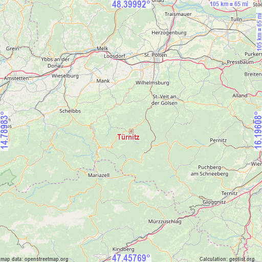
Türnitz GPS coordinates[2]
47° 55' 51.42" North, 15° 29' 34.62" East
| Map corner | latitude | longitude |
|---|---|---|
| Upper-left | 48.39992°, | 14.78983° |
| Center: | 47.93095°, | 15.49295° |
| Lower-right: | 47.45769°, | 16.19608° |
| Map W x H: | 104.8×104.8 km | = 65.1×65.1mi |
| max Lat: | 48.98333° ⇑37.8% North |
| Türnitz: | 47.93095° |
| min Lat: | ⇓62.2% South 46.48841° |
| min Long | Türnitz | max Long |
| 9.57802° | 15.49295° | 17.1° |
| W 65.4%⇐ | ⇒34.6% E |
Elevation
Elevation of Türnitz is 457 m = 1499 ft, and this is 48.5 m = 159 ft below average elevation for this country.
| Max E: |
2140 m = 7021 ft | 49% |
| Avg. | 505.5 m = 1658 ft | |
| Türnitz | 457 m = 1499 ft | |
Min E: |
118 m = 387 ft | 51% |
See also: Austria elevation on elevation.city.
Geographical zone
Türnitz is located in North temperate zone (between Tropic of Cancer and the Arctic Circle). Distance of this North polar circle is 2071.8 km =1287.4 mi to North.| Distance of | km | miles | from Türnitz |
|---|---|---|---|
| North Pole | 4677.6 | 2906.5 | to North |
| Arctic Circle | 2071.8 | 1287.4 | to North |
| Tropic Cancer | 2723.5 | 1692.3 | to South |
| Equator | 5329.4 | 3311.5 | to South |


Nearby cities:
15 places around Türnitz: (largest is in red/bold)
• Annaberg
10.9 km =6.8 mi,  232°
232°
• Eschenau
14.2 km =8.8 mi,  22°
22°
• Frankenfels
13.7 km =8.5 mi,  294°
294°
• Hohenberg
9.8 km =6.1 mi,  105°
105°
• Kirchberg an der Pielach
11.7 km =7.3 mi,  335°
335°
• Lilienfeld
12 km =7.5 mi,  40°
40°
• Loich
9.9 km =6.2 mi,  316°
316°
• Marktl
13.1 km =8.1 mi, 38°
• Puchenstuben
15.3 km =9.5 mi,  268°
268°
• Rabenstein an der Pielach
15.1 km =9.4 mi,  352°
352°
• Sankt Aegyd am Neuwalde
10.3 km =6.4 mi,  146°
146°
• Schwarzenbach an der Pielach
8.2 km =5.1 mi, 271°
• Soisgegend
7.3 km =4.5 mi, 338°
• Stangental
10.9 km =6.8 mi, 36°
• Traisen
13.9 km =8.6 mi,  34°
34°
Sources, notices
• [Note1] Compared only with cities in Austria existing in our database
• [Src1] Map data: © OpenStreetMap contributors (CC-BY-SA)
• [Src2] Other city data from geonames.org with taken over terms of usage.
• [Src3] Geographical zone / Annual Mean Temperature by Robert A. Rohde @ Wikipedia
