Frankenfels geodata
Frankenfels (Lower Austria) is a seat of a third-order administrative division; located in Austria in Europe/Vienna (GMT+2) time zone. With population of 439 people, there are 2577 cities with bigger population in this country. Compared to other cities in Austria, 65% of cities are located further ↓South; 60.9% of cities are located further ←West and 51.2% of cities have lower elevation than Frankenfels. Note1
Administrative division(s):
- Level 1: Lower Austria
- Level 2: Politischer Bezirk Sankt Pölten
- Level 3: Frankenfels


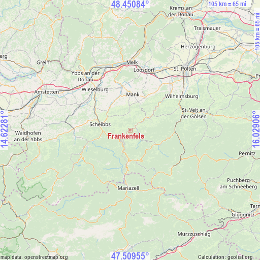
Frankenfels GPS coordinates[2]
47° 58' 56.424" North, 15° 19' 33.348" East
| Map corner | latitude | longitude |
|---|---|---|
| Upper-left | 48.45084°, | 14.62281° |
| Center: | 47.98234°, | 15.32593° |
| Lower-right: | 47.50955°, | 16.02906° |
| Map W x H: | 104.7×104.7 km | = 65.1×65.1mi |
| max Lat: | 48.98333° ⇑35% North |
| Frankenfels: | 47.98234° |
| min Lat: | ⇓65% South 46.48841° |
| min Long | Frankenfels | max Long |
| 9.57802° | 15.32593° | 17.1° |
| W 60.9%⇐ | ⇒39.1% E |
Elevation
Elevation of Frankenfels is 458 m = 1503 ft, and this is 47.5 m = 156 ft below average elevation for this country.
| Max E: |
2140 m = 7021 ft | 48.8% |
| Avg. | 505.5 m = 1658 ft | |
| Frankenfels | 458 m = 1503 ft | |
Min E: |
118 m = 387 ft | 51.2% |
See also: Austria elevation on elevation.city.
Geographical zone
Frankenfels is located in North temperate zone (between Tropic of Cancer and the Arctic Circle). Distance of this North polar circle is 2066 km =1283.8 mi to North.| Distance of | km | miles | from Frankenfels |
|---|---|---|---|
| North Pole | 4671.9 | 2903 | to North |
| Arctic Circle | 2066 | 1283.8 | to North |
| Tropic Cancer | 2729.2 | 1695.8 | to South |
| Equator | 5335.1 | 3315.1 | to South |


Nearby cities:
15 places around Frankenfels: (largest is in red/bold)
• Annaberg
12.9 km =8 mi,  163°
163°
• Dorf Au
13.9 km =8.6 mi,  47°
47°
• Gries bei Oberndorf
12.5 km =7.8 mi,  317°
317°
• Kirchberg an der Pielach
9.1 km =5.7 mi,  57°
57°
• Kirnberg an der Mank
10 km =6.2 mi,  358°
358°
• Loich
5.8 km =3.6 mi,  75°
75°
• Mank
14.3 km =8.9 mi,  3°
3°
• Oberndorf an der Melk
11.8 km =7.3 mi, 320°
• Puchenstuben
6.7 km =4.2 mi,  205°
205°
• Rabenstein an der Pielach
14 km =8.7 mi, 48°
• Sankt Georgen an der Leys
9.2 km =5.7 mi,  306°
306°
• Scheibbs
12 km =7.5 mi,  281°
281°
• Schwarzenbach an der Pielach
6.9 km =4.3 mi,  141°
141°
• Soisgegend
9.8 km =6.1 mi, 83°
• Türnitz
13.7 km =8.5 mi,  114°
114°
Sources, notices
• [Note1] Compared only with cities in Austria existing in our database
• [Src1] Map data: © OpenStreetMap contributors (CC-BY-SA)
• [Src2] Other city data from geonames.org with taken over terms of usage.
• [Src3] Geographical zone / Annual Mean Temperature by Robert A. Rohde @ Wikipedia
