Hohenberg geodata
Hohenberg (Lower Austria) is a seat of a third-order administrative division; located in Austria in Europe/Vienna (GMT+2) time zone. With population of 850 people, there are 1515 cities with bigger population in this country. Compared to other cities in Austria, 61.4% of cities are located further ↓South; 69.6% of cities are located further ←West and 55.6% of cities have lower elevation than Hohenberg. Note1
Administrative division(s):
- Level 1: Lower Austria
- Level 2: Politischer Bezirk Lilienfeld
- Level 3: Hohenberg


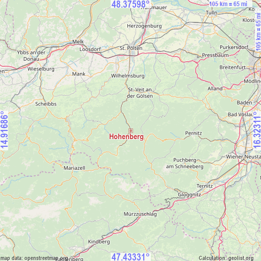
Hohenberg GPS coordinates[2]
47° 54' 24.444" North, 15° 37' 11.928" East
| Map corner | latitude | longitude |
|---|---|---|
| Upper-left | 48.37598°, | 14.91686° |
| Center: | 47.90679°, | 15.61998° |
| Lower-right: | 47.43331°, | 16.32311° |
| Map W x H: | 104.8×104.8 km | = 65.1×65.1mi |
| max Lat: | 48.98333° ⇑38.6% North |
| Hohenberg: | 47.90679° |
| min Lat: | ⇓61.4% South 46.48841° |
| min Long | Hohenberg | max Long |
| 9.57802° | 15.61998° | 17.1° |
| W 69.6%⇐ | ⇒30.4% E |
Elevation
Elevation of Hohenberg is 489 m = 1604 ft, and this is 16.5 m = 54 ft below average elevation for this country.
| Max E: |
2140 m = 7021 ft | 44.4% |
| Avg. | 505.5 m = 1658 ft | |
| Hohenberg | 489 m = 1604 ft | |
Min E: |
118 m = 387 ft | 55.6% |
See also: Austria elevation on elevation.city.
Geographical zone
Hohenberg is located in North temperate zone (between Tropic of Cancer and the Arctic Circle). Distance of this North polar circle is 2074.4 km =1289 mi to North.| Distance of | km | miles | from Hohenberg |
|---|---|---|---|
| North Pole | 4680.3 | 2908.2 | to North |
| Arctic Circle | 2074.4 | 1289 | to North |
| Tropic Cancer | 2720.8 | 1690.6 | to South |
| Equator | 5326.7 | 3309.9 | to South |


Nearby cities:
15 places around Hohenberg: (largest is in red/bold)
• Eschenau
16.2 km =10.1 mi,  345°
345°
• Gölsen
17.6 km =10.9 mi,  31°
31°
• Kleinzell
11.9 km =7.4 mi,  46°
46°
• Lilienfeld
11.9 km =7.4 mi, 351°
• Marktl
13 km =8.1 mi, 354°
• Rainfeld
17 km =10.6 mi,  23°
23°
• Ramsau
17.4 km =10.8 mi, 51°
• Rohr im Gebirge
8.8 km =5.5 mi,  98°
98°
• Sankt Aegyd am Neuwalde
7 km =4.3 mi,  212°
212°
• Sankt Veit an der Gölsen
15.6 km =9.7 mi,  13°
13°
• Schwarzau im Gebirge
12.3 km =7.6 mi,  148°
148°
• Soisgegend
15.4 km =9.6 mi,  307°
307°
• Stangental
11.8 km =7.3 mi, 345°
• Traisen
14.1 km =8.8 mi, 353°
• Türnitz
9.8 km =6.1 mi,  285°
285°
Sources, notices
• [Note1] Compared only with cities in Austria existing in our database
• [Src1] Map data: © OpenStreetMap contributors (CC-BY-SA)
• [Src2] Other city data from geonames.org with taken over terms of usage.
• [Src3] Geographical zone / Annual Mean Temperature by Robert A. Rohde @ Wikipedia
