Trebesing geodata
Trebesing (Carinthia) is a seat of a third-order administrative division; located in Austria in Europe/Vienna (GMT+2) time zone. With population of 174 people, there are 2874 cities with bigger population in this country. Compared to other cities in Austria, 88.2% of cities are located further ↑North; 74.7% of cities are located further →East and 84.5% of cities have lower elevation than Trebesing. Note1
Administrative division(s):
- Level 1: Carinthia
- Level 2: Politischer Bezirk Spittal an der Drau
- Level 3: Trebesing


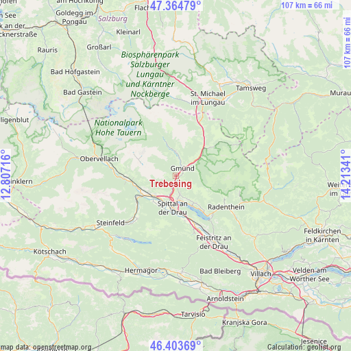
Trebesing GPS coordinates[2]
46° 53' 11.004" North, 13° 30' 37.008" East
| Map corner | latitude | longitude |
|---|---|---|
| Upper-left | 47.36479°, | 12.80716° |
| Center: | 46.88639°, | 13.51028° |
| Lower-right: | 46.40369°, | 14.21341° |
| Map W x H: | 106.9×106.9 km | = 66.4×66.4mi |
| max Lat: | 48.98333° ⇑88.2% North |
| Trebesing: | 46.88639° |
| min Lat: | ⇓11.8% South 46.48841° |
| min Long | Trebesing | max Long |
| 9.57802° | 13.51028° | 17.1° |
| W 25.3%⇐ | ⇒74.7% E |
Elevation
Elevation of Trebesing is 790 m = 2592 ft, and this is 284.5 m = 933 ft above average elevation for this country.
| Max E: |
2140 m = 7021 ft | 15.5% |
| Trebesing | 790 m 2592 ft | |
| Avg. | 505.5 m = 1658 ft | |
Min E: |
118 m = 387 ft | 84.5% |
See also: Austria elevation on elevation.city.
Geographical zone
Trebesing is located in North temperate zone (between Tropic of Cancer and the Arctic Circle). Distance of this North polar circle is 2187.9 km =1359.5 mi to North.| Distance of | km | miles | from Trebesing |
|---|---|---|---|
| North Pole | 4793.8 | 2978.7 | to North |
| Arctic Circle | 2187.9 | 1359.5 | to North |
| Tropic Cancer | 2607.4 | 1620.2 | to South |
| Equator | 5213.3 | 3239.4 | to South |


Nearby cities:
15 places around Trebesing: (largest is in red/bold)
• Baldramsdorf
10.4 km =6.5 mi,  204°
204°
• Döbriach
16.2 km =10.1 mi,  136°
136°
• Gmünd
2.7 km =1.7 mi,  32°
32°
• Kaning
16.5 km =10.3 mi,  113°
113°
• Lendorf
8.3 km =5.2 mi,  226°
226°
• Lieserbrücke
6.2 km =3.9 mi, 199°
• Malta
7.5 km =4.7 mi,  358°
358°
• Millstatt
10.6 km =6.6 mi,  149°
149°
• Möllbrücke
11.8 km =7.3 mi,  241°
241°
• Mühldorf
12.3 km =7.6 mi,  256°
256°
• Obermillstatt
10.7 km =6.6 mi, 139°
• Pusarnitz
10.3 km =6.4 mi, 234°
• Sachsenburg
13.4 km =8.3 mi, 241°
• Seeboden
7.5 km =4.7 mi,  177°
177°
• Spittal an der Drau
9.6 km =6 mi, 184°
Sources, notices
• [Note1] Compared only with cities in Austria existing in our database
• [Src1] Map data: © OpenStreetMap contributors (CC-BY-SA)
• [Src2] Other city data from geonames.org with taken over terms of usage.
• [Src3] Geographical zone / Annual Mean Temperature by Robert A. Rohde @ Wikipedia
