Millstatt geodata
Millstatt (Carinthia) is a seat of a third-order administrative division; located in Austria in Europe/Vienna (GMT+2) time zone. With population of 889 people, there are 1451 cities with bigger population in this country. Compared to other cities in Austria, 91.8% of cities are located further ↑North; 73.8% of cities are located further →East and 78.6% of cities have lower elevation than Millstatt. Note1
Administrative division(s):
- Level 1: Carinthia
- Level 2: Politischer Bezirk Spittal an der Drau
- Level 3: Millstatt


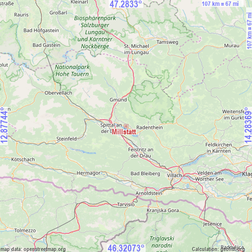
Millstatt GPS coordinates[2]
46° 48' 15.012" North, 13° 34' 50.016" East
| Map corner | latitude | longitude |
|---|---|---|
| Upper-left | 47.2833°, | 12.87744° |
| Center: | 46.80417°, | 13.58056° |
| Lower-right: | 46.32073°, | 14.28369° |
| Map W x H: | 107×107 km | = 66.5×66.5mi |
| max Lat: | 48.98333° ⇑91.8% North |
| Millstatt: | 46.80417° |
| min Lat: | ⇓8.2% South 46.48841° |
| min Long | Millstatt | max Long |
| 9.57802° | 13.58056° | 17.1° |
| W 26.2%⇐ | ⇒73.8% E |
Elevation
Elevation of Millstatt is 695 m = 2280 ft, and this is 189.5 m = 622 ft above average elevation for this country.
| Max E: |
2140 m = 7021 ft | 21.4% |
| Millstatt | 695 m 2280 ft | |
| Avg. | 505.5 m = 1658 ft | |
Min E: |
118 m = 387 ft | 78.6% |
See also: Austria elevation on elevation.city.
Geographical zone
Millstatt is located in North temperate zone (between Tropic of Cancer and the Arctic Circle). Distance of this North polar circle is 2197 km =1365.2 mi to North.| Distance of | km | miles | from Millstatt |
|---|---|---|---|
| North Pole | 4802.9 | 2984.4 | to North |
| Arctic Circle | 2197 | 1365.2 | to North |
| Tropic Cancer | 2598.2 | 1614.4 | to South |
| Equator | 5204.1 | 3233.7 | to South |


Nearby cities:
15 places around Millstatt: (largest is in red/bold)
• Baldramsdorf
9.7 km =6 mi,  267°
267°
• Döbriach
6.4 km =4 mi,  114°
114°
• Ferndorf
8.3 km =5.2 mi,  155°
155°
• Kaning
10.1 km =6.3 mi,  75°
75°
• Lendorf
11.9 km =7.4 mi,  286°
286°
• Lieserbrücke
8.1 km =5 mi, 293°
• Nikelsdorf
12 km =7.5 mi, 155°
• Obermillstatt
2 km =1.2 mi,  56°
56°
• Paternion
10.9 km =6.8 mi, 157°
• Radenthein
10 km =6.2 mi,  92°
92°
• Seeboden
5.3 km =3.3 mi, 288°
• Spittal an der Drau
6.1 km =3.8 mi, 265°
• Stockenboi
9.7 km =6 mi,  206°
206°
• Trebesing
10.6 km =6.6 mi,  329°
329°
• Untertweng
11.9 km =7.4 mi,  97°
97°
Sources, notices
• [Note1] Compared only with cities in Austria existing in our database
• [Src1] Map data: © OpenStreetMap contributors (CC-BY-SA)
• [Src2] Other city data from geonames.org with taken over terms of usage.
• [Src3] Geographical zone / Annual Mean Temperature by Robert A. Rohde @ Wikipedia
