Strasswalchen geodata
Strasswalchen (Salzburg) is a seat of a third-order administrative division; located in Austria in Europe/Vienna (GMT+2) time zone. With population of 3,765 people, there are 283 cities with bigger population in this country. Compared to other cities in Austria, 64.9% of cities are located further ↓South; 78.2% of cities are located further →East and 61.9% of cities have lower elevation than Strasswalchen. Note1
Administrative division(s):
- Level 1: Salzburg
- Level 2: Politischer Bezirk Salzburg-Umgebung
- Level 3: Straßwalchen


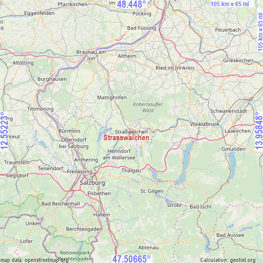
Strasswalchen GPS coordinates[2]
47° 58' 46.092" North, 13° 15' 19.26" East
| Map corner | latitude | longitude |
|---|---|---|
| Upper-left | 48.448°, | 12.55223° |
| Center: | 47.97947°, | 13.25535° |
| Lower-right: | 47.50665°, | 13.95848° |
| Map W x H: | 104.7×104.7 km | = 65.1×65.1mi |
| max Lat: | 48.98333° ⇑35.1% North |
| Strasswalchen: | 47.97947° |
| min Lat: | ⇓64.9% South 46.48841° |
| min Long | Strasswalchen | max Long |
| 9.57802° | 13.25535° | 17.1° |
| W 21.8%⇐ | ⇒78.2% E |
Elevation
Elevation of Strasswalchen is 530 m = 1739 ft, and this is 24.5 m = 80 ft above average elevation for this country.
| Max E: |
2140 m = 7021 ft | 38.1% |
| Strasswalchen | 530 m 1739 ft | |
| Avg. | 505.5 m = 1658 ft | |
Min E: |
118 m = 387 ft | 61.9% |
See also: Austria elevation on elevation.city.
Geographical zone
Strasswalchen is located in North temperate zone (between Tropic of Cancer and the Arctic Circle). Distance of this North polar circle is 2066.4 km =1284 mi to North.| Distance of | km | miles | from Strasswalchen |
|---|---|---|---|
| North Pole | 4672.2 | 2903.2 | to North |
| Arctic Circle | 2066.4 | 1284 | to North |
| Tropic Cancer | 2728.9 | 1695.7 | to South |
| Equator | 5334.8 | 3314.9 | to South |


Nearby cities:
15 places around Strasswalchen: (largest is in red/bold)
• Friedburg
4.2 km =2.6 mi,  354°
354°
• Henndorf am Wallersee
10.3 km =6.4 mi,  211°
211°
• Irrsdorf
2.5 km =1.6 mi,  124°
124°
• Köstendorf
5.3 km =3.3 mi,  231°
231°
• Lengau
4.1 km =2.5 mi,  315°
315°
• Lochen
6.5 km =4 mi,  299°
299°
• Munderfing
11.5 km =7.1 mi,  331°
331°
• Neumarkt am Wallersee
3.7 km =2.3 mi, 206°
• Oberhofen am Irrsee
4.7 km =2.9 mi,  134°
134°
• Palting
10.3 km =6.4 mi,  292°
292°
• Schalkham
5.9 km =3.7 mi, 209°
• Schleedorf
8.5 km =5.3 mi,  247°
247°
• Schneegattern
5.7 km =3.5 mi,  30°
30°
• Steindorf
2.4 km =1.5 mi, 208°
• Zell am Moos
9.9 km =6.2 mi,  152°
152°
Sources, notices
• [Note1] Compared only with cities in Austria existing in our database
• [Src1] Map data: © OpenStreetMap contributors (CC-BY-SA)
• [Src2] Other city data from geonames.org with taken over terms of usage.
• [Src3] Geographical zone / Annual Mean Temperature by Robert A. Rohde @ Wikipedia
