Schneegattern geodata
Schneegattern (Upper Austria) is a populated place; located in Austria in Europe/Vienna (GMT+2) time zone. With population of 929 people, there are 1384 cities with bigger population in this country. Compared to other cities in Austria, 68% of cities are located further ↓South; 78% of cities are located further →East and 62.9% of cities have lower elevation than Schneegattern. Note1
Administrative division(s):
- Level 1: Upper Austria
- Level 2: Politischer Bezirk Braunau am Inn
- Level 3: Lengau


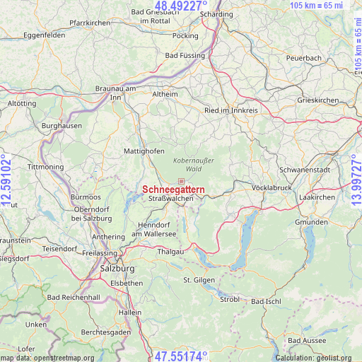
Schneegattern GPS coordinates[2]
48° 1' 26.94" North, 13° 17' 38.904" East
| Map corner | latitude | longitude |
|---|---|---|
| Upper-left | 48.49227°, | 12.59102° |
| Center: | 48.02415°, | 13.29414° |
| Lower-right: | 47.55174°, | 13.99727° |
| Map W x H: | 104.6×104.6 km | = 65×65mi |
| max Lat: | 48.98333° ⇑32% North |
| Schneegattern: | 48.02415° |
| min Lat: | ⇓68% South 46.48841° |
| min Long | Schneegattern | max Long |
| 9.57802° | 13.29414° | 17.1° |
| W 22%⇐ | ⇒78% E |
Elevation
Elevation of Schneegattern is 538 m = 1765 ft, and this is 32.5 m = 107 ft above average elevation for this country.
| Max E: |
2140 m = 7021 ft | 37.1% |
| Schneegattern | 538 m 1765 ft | |
| Avg. | 505.5 m = 1658 ft | |
Min E: |
118 m = 387 ft | 62.9% |
See also: Austria elevation on elevation.city.
Geographical zone
Schneegattern is located in North temperate zone (between Tropic of Cancer and the Arctic Circle). Distance of this North polar circle is 2061.4 km =1280.9 mi to North.| Distance of | km | miles | from Schneegattern |
|---|---|---|---|
| North Pole | 4667.3 | 2900.1 | to North |
| Arctic Circle | 2061.4 | 1280.9 | to North |
| Tropic Cancer | 2733.9 | 1698.8 | to South |
| Equator | 5339.8 | 3318 | to South |


Nearby cities:
15 places around Schneegattern: (largest is in red/bold)
• Fornach
10.1 km =6.3 mi,  90°
90°
• Frankenmarkt
10.2 km =6.3 mi,  116°
116°
• Friedburg
3.4 km =2.1 mi,  255°
255°
• Irrsdorf
6.4 km =4 mi,  187°
187°
• Köstendorf
10.8 km =6.7 mi,  220°
220°
• Lengau
6.1 km =3.8 mi,  250°
250°
• Lochen
8.7 km =5.4 mi, 258°
• Munderfing
9.8 km =6.1 mi,  301°
301°
• Neumarkt am Wallersee
9.4 km =5.8 mi,  208°
208°
• Oberhofen am Irrsee
8.3 km =5.2 mi,  176°
176°
• Palting
12.5 km =7.8 mi,  265°
265°
• Schalkham
11.6 km =7.2 mi, 209°
• Steindorf
8.2 km =5.1 mi, 209°
• Strasswalchen
5.7 km =3.5 mi, 210°
• Weißenkirchen im Attergau
12.4 km =7.7 mi,  131°
131°
Sources, notices
• [Note1] Compared only with cities in Austria existing in our database
• [Src1] Map data: © OpenStreetMap contributors (CC-BY-SA)
• [Src2] Other city data from geonames.org with taken over terms of usage.
• [Src3] Geographical zone / Annual Mean Temperature by Robert A. Rohde @ Wikipedia
