Straßburg-Stadt geodata
Straßburg-Stadt (Carinthia) is a seat of a third-order administrative division; located in Austria in Europe/Vienna (GMT+2) time zone. With population of 1,255 people, there are 1003 cities with bigger population in this country. Compared to other cities in Austria, 88% of cities are located further ↑North; 57.2% of cities are located further →East and 74.9% of cities have lower elevation than Straßburg-Stadt. Note1
Administrative division(s):
- Level 1: Carinthia
- Level 2: Politischer Bezirk Sankt Veit an der Glan
- Level 3: Straßburg


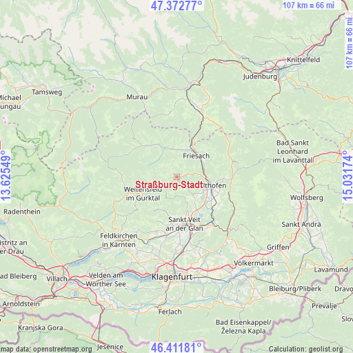
Straßburg-Stadt GPS coordinates[2]
46° 53' 39.984" North, 14° 19' 42.996" East
| Map corner | latitude | longitude |
|---|---|---|
| Upper-left | 47.37277°, | 13.62549° |
| Center: | 46.89444°, | 14.32861° |
| Lower-right: | 46.41181°, | 15.03174° |
| Map W x H: | 106.8×106.8 km | = 66.4×66.4mi |
| max Lat: | 48.98333° ⇑88% North |
| Straßburg-Stadt: | 46.89444° |
| min Lat: | ⇓12% South 46.48841° |
| min Long | Straßburg-Stad | max Long |
| 9.57802° | 14.32861° | 17.1° |
| W 42.8%⇐ | ⇒57.2% E |
Elevation
Elevation of Straßburg-Stadt is 647 m = 2123 ft, and this is 141.5 m = 464 ft above average elevation for this country.
| Max E: |
2140 m = 7021 ft | 25.1% |
| Straßburg-Stadt | 647 m 2123 ft | |
| Avg. | 505.5 m = 1658 ft | |
Min E: |
118 m = 387 ft | 74.9% |
See also: Austria elevation on elevation.city.
Geographical zone
Straßburg-Stadt is located in North temperate zone (between Tropic of Cancer and the Arctic Circle). Distance of this North polar circle is 2187 km =1358.9 mi to North.| Distance of | km | miles | from Straßburg-Stadt |
|---|---|---|---|
| North Pole | 4792.9 | 2978.2 | to North |
| Arctic Circle | 2187 | 1358.9 | to North |
| Tropic Cancer | 2608.3 | 1620.7 | to South |
| Equator | 5214.2 | 3240 | to South |


Nearby cities:
15 places around Straßburg-Stadt: (largest is in red/bold)
• Althofen
11.3 km =7 mi,  102°
102°
• Dürnstein in der Steiermark
11.5 km =7.1 mi,  24°
24°
• Frauenstein
9.3 km =5.8 mi,  196°
196°
• Friesach
9 km =5.6 mi,  40°
40°
• Gurk
3.6 km =2.2 mi,  230°
230°
• Guttaring
13.9 km =8.6 mi,  94°
94°
• Kappel am Krappfeld
13.5 km =8.4 mi,  117°
117°
• Kraig
9.5 km =5.9 mi,  161°
161°
• Metnitz
12.8 km =8 mi,  318°
318°
• Micheldorf
7.1 km =4.4 mi,  69°
69°
• Micheldorf in Kärnten
7.8 km =4.8 mi, 73°
• Mölbling
9.4 km =5.8 mi, 121°
• Sankt Salvator
8.7 km =5.4 mi,  14°
14°
• Treibach
10.9 km =6.8 mi,  106°
106°
• Weitensfeld
11.6 km =7.2 mi,  243°
243°
Sources, notices
• [Note1] Compared only with cities in Austria existing in our database
• [Src1] Map data: © OpenStreetMap contributors (CC-BY-SA)
• [Src2] Other city data from geonames.org with taken over terms of usage.
• [Src3] Geographical zone / Annual Mean Temperature by Robert A. Rohde @ Wikipedia
