Gurk geodata
Gurk (Carinthia) is a seat of a third-order administrative division; located in Austria in Europe/Vienna (GMT+2) time zone. With population of 857 people, there are 1506 cities with bigger population in this country. Compared to other cities in Austria, 88.7% of cities are located further ↑North; 58.1% of cities are located further →East and 76.2% of cities have lower elevation than Gurk. Note1
Administrative division(s):
- Level 1: Carinthia
- Level 2: Politischer Bezirk Sankt Veit an der Glan
- Level 3: Gurk


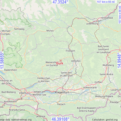
Gurk GPS coordinates[2]
46° 52' 26.004" North, 14° 17' 30.012" East
| Map corner | latitude | longitude |
|---|---|---|
| Upper-left | 47.3524°, | 13.58855° |
| Center: | 46.87389°, | 14.29167° |
| Lower-right: | 46.39108°, | 14.9948° |
| Map W x H: | 106.9×106.9 km | = 66.4×66.4mi |
| max Lat: | 48.98333° ⇑88.7% North |
| Gurk: | 46.87389° |
| min Lat: | ⇓11.3% South 46.48841° |
| min Long | Gurk | max Long |
| 9.57802° | 14.29167° | 17.1° |
| W 41.9%⇐ | ⇒58.1% E |
Elevation
Elevation of Gurk is 665 m = 2182 ft, and this is 159.5 m = 523 ft above average elevation for this country.
| Max E: |
2140 m = 7021 ft | 23.8% |
| Gurk | 665 m 2182 ft | |
| Avg. | 505.5 m = 1658 ft | |
Min E: |
118 m = 387 ft | 76.2% |
See also: Austria elevation on elevation.city.
Geographical zone
Gurk is located in North temperate zone (between Tropic of Cancer and the Arctic Circle). Distance of this North polar circle is 2189.3 km =1360.4 mi to North.| Distance of | km | miles | from Gurk |
|---|---|---|---|
| North Pole | 4795.2 | 2979.6 | to North |
| Arctic Circle | 2189.3 | 1360.4 | to North |
| Tropic Cancer | 2606 | 1619.3 | to South |
| Equator | 5211.9 | 3238.5 | to South |


Nearby cities:
15 places around Gurk: (largest is in red/bold)
• Althofen
13.9 km =8.6 mi,  90°
90°
• Dürnstein in der Steiermark
14.8 km =9.2 mi,  30°
30°
• Frauenstein
6.6 km =4.1 mi,  178°
178°
• Friesach
12.5 km =7.8 mi,  43°
43°
• Glödnitz
13.1 km =8.1 mi,  270°
270°
• Kraig
8.9 km =5.5 mi,  139°
139°
• Metnitz
13.2 km =8.2 mi,  334°
334°
• Micheldorf
10.6 km =6.6 mi,  63°
63°
• Micheldorf in Kärnten
11.3 km =7 mi,  66°
66°
• Mölbling
11.1 km =6.9 mi,  103°
103°
• Sankt Salvator
11.8 km =7.3 mi,  24°
24°
• Sankt Veit an der Glan
12.9 km =8 mi,  156°
156°
• Straßburg-Stadt
3.6 km =2.2 mi,  50°
50°
• Treibach
13.3 km =8.3 mi, 93°
• Weitensfeld
8.1 km =5 mi,  248°
248°
Sources, notices
• [Note1] Compared only with cities in Austria existing in our database
• [Src1] Map data: © OpenStreetMap contributors (CC-BY-SA)
• [Src2] Other city data from geonames.org with taken over terms of usage.
• [Src3] Geographical zone / Annual Mean Temperature by Robert A. Rohde @ Wikipedia
