Stössing geodata
Stössing (Lower Austria) is a seat of a third-order administrative division; located in Austria in Europe/Vienna (GMT+2) time zone. With population of 256 people, there are 2802 cities with bigger population in this country. Compared to other cities in Austria, 74% of cities are located further ↓South; 75% of cities are located further ←West and 67.1% of cities have higher elevation than Stössing. Note1
Administrative division(s):
- Level 1: Lower Austria
- Level 2: Politischer Bezirk Sankt Pölten
- Level 3: Stössing


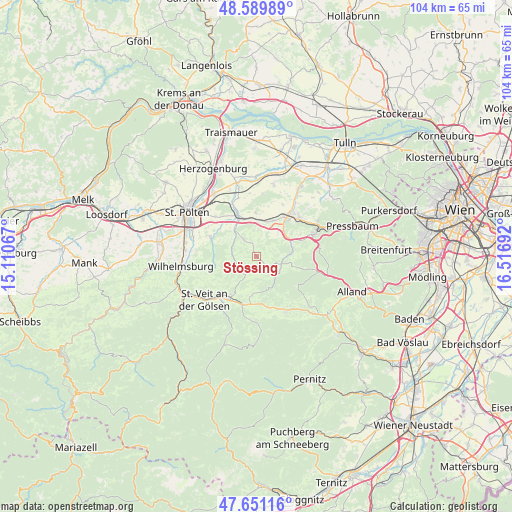
Stössing GPS coordinates[2]
48° 7' 21.612" North, 15° 48' 49.644" East
| Map corner | latitude | longitude |
|---|---|---|
| Upper-left | 48.58989°, | 15.11067° |
| Center: | 48.12267°, | 15.81379° |
| Lower-right: | 47.65116°, | 16.51692° |
| Map W x H: | 104.4×104.4 km | = 64.9×64.9mi |
| max Lat: | 48.98333° ⇑26% North |
| Stössing: | 48.12267° |
| min Lat: | ⇓74% South 46.48841° |
| min Long | Stössing | max Long |
| 9.57802° | 15.81379° | 17.1° |
| W 75%⇐ | ⇒25% E |
Elevation
Elevation of Stössing is 342 m = 1122 ft, and this is 163.5 m = 536 ft below average elevation for this country.
| Max E: |
2140 m = 7021 ft | 67.1% |
| Avg. | 505.5 m = 1658 ft | |
| Stössing | 342 m = 1122 ft | |
Min E: |
118 m = 387 ft | 32.9% |
See also: Austria elevation on elevation.city.
Geographical zone
Stössing is located in North temperate zone (between Tropic of Cancer and the Arctic Circle). Distance of this North polar circle is 2050.4 km =1274.1 mi to North.| Distance of | km | miles | from Stössing |
|---|---|---|---|
| North Pole | 4656.3 | 2893.3 | to North |
| Arctic Circle | 2050.4 | 1274.1 | to North |
| Tropic Cancer | 2744.8 | 1705.5 | to South |
| Equator | 5350.7 | 3324.8 | to South |


Nearby cities:
15 places around Stössing: (largest is in red/bold)
• Altlengbach
9 km =5.6 mi,  67°
67°
• Böheimkirchen
9.2 km =5.7 mi,  335°
335°
• Ebersberg
10 km =6.2 mi,  34°
34°
• Gölsen
10.4 km =6.5 mi,  210°
210°
• Haag
9.9 km =6.2 mi,  40°
40°
• Hainfeld
10.3 km =6.4 mi,  196°
196°
• Innermanzing
7.5 km =4.7 mi,  80°
80°
• Kasten bei Böheimkirchen
4.2 km =2.6 mi,  323°
323°
• Kirchstetten
6.7 km =4.2 mi,  1°
1°
• Maria-Anzbach
11.5 km =7.1 mi,  49°
49°
• Neulengbach
10.6 km =6.6 mi, 38°
• Ollersbach
7.5 km =4.7 mi,  17°
17°
• Pyhra
10.3 km =6.4 mi,  293°
293°
• Rainfeld
11.3 km =7 mi,  222°
222°
• Rohrbach an der Gölsen
10 km =6.2 mi, 212°
Sources, notices
• [Note1] Compared only with cities in Austria existing in our database
• [Src1] Map data: © OpenStreetMap contributors (CC-BY-SA)
• [Src2] Other city data from geonames.org with taken over terms of usage.
• [Src3] Geographical zone / Annual Mean Temperature by Robert A. Rohde @ Wikipedia
