Pyhra geodata
Pyhra (Lower Austria) is a seat of a third-order administrative division; located in Austria in Europe/Vienna (GMT+2) time zone. With population of 1,179 people, there are 1071 cities with bigger population in this country. Compared to other cities in Austria, 76.3% of cities are located further ↓South; 71.6% of cities are located further ←West and 76.6% of cities have higher elevation than Pyhra. Note1
Administrative division(s):
- Level 1: Lower Austria
- Level 2: Politischer Bezirk Sankt Pölten
- Level 3: Pyhra


Pyhra GPS coordinates[2]
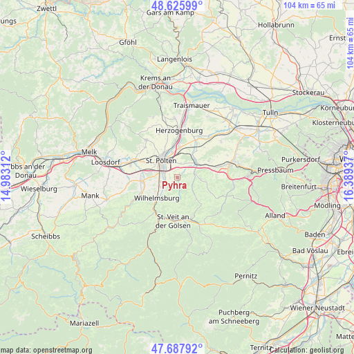
48° 9' 32.76" North, 15° 41' 10.464" East
| Map corner | latitude | longitude |
|---|---|---|
| Upper-left | 48.62599°, | 14.98312° |
| Center: | 48.1591°, | 15.68624° |
| Lower-right: | 47.68792°, | 16.38937° |
| Map W x H: | 104.3×104.3 km | = 64.8×64.8mi |
| max Lat: | 48.98333° ⇑23.7% North |
| Pyhra: | 48.1591° |
| min Lat: | ⇓76.3% South 46.48841° |
| min Long | Pyhra | max Long |
| 9.57802° | 15.68624° | 17.1° |
| W 71.6%⇐ | ⇒28.4% E |
Elevation
Elevation of Pyhra is 293 m = 961 ft, and this is 212.5 m = 697 ft below average elevation for this country.
| Max E: |
2140 m = 7021 ft | 76.6% |
| Avg. | 505.5 m = 1658 ft | |
| Pyhra | 293 m = 961 ft | |
Min E: |
118 m = 387 ft | 23.4% |
See also: Austria elevation on elevation.city.
Geographical zone
Pyhra is located in North temperate zone (between Tropic of Cancer and the Arctic Circle). Distance of this North polar circle is 2046.4 km =1271.6 mi to North.| Distance of | km | miles | from Pyhra |
|---|---|---|---|
| North Pole | 4652.3 | 2890.8 | to North |
| Arctic Circle | 2046.4 | 1271.6 | to North |
| Tropic Cancer | 2748.9 | 1708.1 | to South |
| Equator | 5354.8 | 3327.3 | to South |


Nearby cities:
15 places around Pyhra: (largest is in red/bold)
• Böheimkirchen
7.1 km =4.4 mi,  52°
52°
• Eggendorf
5.8 km =3.6 mi,  237°
237°
• Harland
3.6 km =2.2 mi,  274°
274°
• Hart
5.3 km =3.3 mi,  262°
262°
• Kasten bei Böheimkirchen
6.9 km =4.3 mi,  95°
95°
• Mühlgang
5.6 km =3.5 mi,  248°
248°
• Oberwagram
5.5 km =3.4 mi,  329°
329°
• Pottenbrunn
8.3 km =5.2 mi,  7°
7°
• Ratzersdorf an der Traisen
7.6 km =4.7 mi,  348°
348°
• Sankt Pölten
6 km =3.7 mi,  319°
319°
• Spratzern
5.2 km =3.2 mi,  284°
284°
• Stattersdorf
4.8 km =3 mi,  304°
304°
• Teufelhof
5.8 km =3.6 mi, 297°
• Unterwagram
6.5 km =4 mi,  335°
335°
• Viehofen
8.2 km =5.1 mi, 321°
Sources, notices
• [Note1] Compared only with cities in Austria existing in our database
• [Src1] Map data: © OpenStreetMap contributors (CC-BY-SA)
• [Src2] Other city data from geonames.org with taken over terms of usage.
• [Src3] Geographical zone / Annual Mean Temperature by Robert A. Rohde @ Wikipedia
