Stein an der Donau geodata
Stein an der Donau (Lower Austria) is a section of populated place; located in Austria in Europe/Vienna (GMT+2) time zone. With population of 2,024 people, there are 605 cities with bigger population in this country. Compared to other cities in Austria, 90.9% of cities are located further ↓South; 68% of cities are located further ←West and 92% of cities have higher elevation than Stein an der Donau. Note1
Administrative division(s):
- Level 1: Lower Austria
- Level 2: Krems an der Donau Stadt
- Level 3: Krems an der Donau


Stein an der Donau GPS coordinates[2]
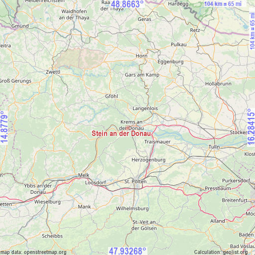
48° 24' 5.868" North, 15° 34' 51.672" East
| Map corner | latitude | longitude |
|---|---|---|
| Upper-left | 48.8663°, | 14.8779° |
| Center: | 48.40163°, | 15.58102° |
| Lower-right: | 47.93268°, | 16.28415° |
| Map W x H: | 103.8×103.8 km | = 64.5×64.5mi |
| max Lat: | 48.98333° ⇑9.1% North |
| Stein an der Donau: | 48.40163° |
| min Lat: | ⇓90.9% South 46.48841° |
| min Long | Stein an der Do | max Long |
| 9.57802° | 15.58102° | 17.1° |
| W 68%⇐ | ⇒32% E |
Elevation
Elevation of Stein an der Donau is 200 m = 656 ft, and this is 305.5 m = 1002 ft below average elevation for this country.
| Max E: |
2140 m = 7021 ft | 92% |
| Avg. | 505.5 m = 1658 ft | |
| Stein an der Donau | 200 m = 656 ft | |
Min E: |
118 m = 387 ft | 8% |
See also: Austria elevation on elevation.city.
Geographical zone
Stein an der Donau is located in North temperate zone (between Tropic of Cancer and the Arctic Circle). Distance of this North polar circle is 2019.4 km =1254.8 mi to North.| Distance of | km | miles | from Stein an der Donau |
|---|---|---|---|
| North Pole | 4625.3 | 2874 | to North |
| Arctic Circle | 2019.4 | 1254.8 | to North |
| Tropic Cancer | 2775.8 | 1724.8 | to South |
| Equator | 5381.8 | 3344.1 | to South |


Nearby cities:
15 places around Stein an der Donau: (largest is in red/bold)
• Dürnstein
4.6 km =2.9 mi,  261°
261°
• Egelsee
2.2 km =1.4 mi,  321°
321°
• Furth bei Göttweig
3.9 km =2.4 mi,  141°
141°
• Gneixendorf
4.8 km =3 mi,  34°
34°
• Imbach
5.4 km =3.4 mi,  1°
1°
• Krems an der Donau
2.6 km =1.6 mi,  70°
70°
• Landersdorf
4.2 km =2.6 mi, 66°
• Lerchenfeld
3.9 km =2.4 mi, 72°
• Mautern
1 km =0.6 mi,  193°
193°
• Palt
3.1 km =1.9 mi,  127°
127°
• Rehberg
3.3 km =2.1 mi,  7°
7°
• Senftenberg
4.2 km =2.6 mi,  326°
326°
• Stratzing
5.6 km =3.5 mi, 14°
• Unterbergern
4.5 km =2.8 mi,  210°
210°
• Weinzierl bei Krems
1.4 km =0.9 mi,  97°
97°
Sources, notices
• [Note1] Compared only with cities in Austria existing in our database
• [Src1] Map data: © OpenStreetMap contributors (CC-BY-SA)
• [Src2] Other city data from geonames.org with taken over terms of usage.
• [Src3] Geographical zone / Annual Mean Temperature by Robert A. Rohde @ Wikipedia
