Mautern geodata
Mautern (Lower Austria) is a populated place; located in Austria in Europe/Vienna (GMT+2) time zone. With population of 2,917 people, there are 395 cities with bigger population in this country. Compared to other cities in Austria, 90.3% of cities are located further ↓South; 67.8% of cities are located further ←West and 91.3% of cities have higher elevation than Mautern. Note1
Administrative division(s):
- Level 1: Lower Austria
- Level 2: Politischer Bezirk Krems
- Level 3: Mautern an der Donau


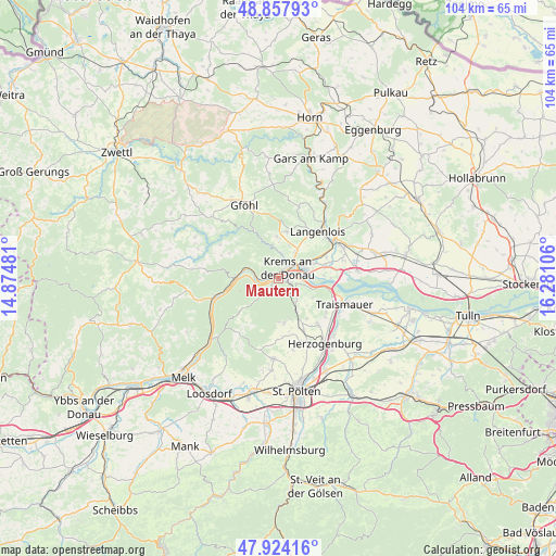
Mautern GPS coordinates[2]
48° 23' 35.484" North, 15° 34' 40.548" East
| Map corner | latitude | longitude |
|---|---|---|
| Upper-left | 48.85793°, | 14.87481° |
| Center: | 48.39319°, | 15.57793° |
| Lower-right: | 47.92416°, | 16.28106° |
| Map W x H: | 103.8×103.8 km | = 64.5×64.5mi |
| max Lat: | 48.98333° ⇑9.7% North |
| Mautern: | 48.39319° |
| min Lat: | ⇓90.3% South 46.48841° |
| min Long | Mautern | max Long |
| 9.57802° | 15.57793° | 17.1° |
| W 67.8%⇐ | ⇒32.2% E |
Elevation
Elevation of Mautern is 205 m = 673 ft, and this is 300.5 m = 986 ft below average elevation for this country.
| Max E: |
2140 m = 7021 ft | 91.3% |
| Avg. | 505.5 m = 1658 ft | |
| Mautern | 205 m = 673 ft | |
Min E: |
118 m = 387 ft | 8.7% |
See also: Austria elevation on elevation.city.
Geographical zone
Mautern is located in North temperate zone (between Tropic of Cancer and the Arctic Circle). Distance of this North polar circle is 2020.4 km =1255.4 mi to North.| Distance of | km | miles | from Mautern |
|---|---|---|---|
| North Pole | 4626.2 | 2874.6 | to North |
| Arctic Circle | 2020.4 | 1255.4 | to North |
| Tropic Cancer | 2774.9 | 1724.2 | to South |
| Equator | 5380.8 | 3343.5 | to South |


Nearby cities:
15 places around Mautern: (largest is in red/bold)
• Dürnstein
4.3 km =2.7 mi,  273°
273°
• Egelsee
2.9 km =1.8 mi,  336°
336°
• Furth bei Göttweig
3.4 km =2.1 mi,  128°
128°
• Gneixendorf
5.8 km =3.6 mi,  31°
31°
• Imbach
6.3 km =3.9 mi,  3°
3°
• Krems an der Donau
3.2 km =2 mi,  56°
56°
• Landersdorf
4.9 km =3 mi, 57°
• Lerchenfeld
4.5 km =2.8 mi, 61°
• Palt
2.8 km =1.7 mi,  109°
109°
• Paudorf
5.3 km =3.3 mi,  145°
145°
• Rehberg
4.3 km =2.7 mi,  9°
9°
• Senftenberg
4.9 km =3 mi, 335°
• Stein an der Donau
1 km =0.6 mi, 13°
• Unterbergern
3.6 km =2.2 mi,  214°
214°
• Weinzierl bei Krems
1.8 km =1.1 mi,  65°
65°
Sources, notices
• [Note1] Compared only with cities in Austria existing in our database
• [Src1] Map data: © OpenStreetMap contributors (CC-BY-SA)
• [Src2] Other city data from geonames.org with taken over terms of usage.
• [Src3] Geographical zone / Annual Mean Temperature by Robert A. Rohde @ Wikipedia
