Rehberg geodata
Rehberg (Lower Austria) is a section of populated place; located in Austria in Europe/Vienna (GMT+2) time zone. With population of 1,766 people, there are 706 cities with bigger population in this country. Compared to other cities in Austria, 91.8% of cities are located further ↓South; 68.3% of cities are located further ←West and 88.4% of cities have higher elevation than Rehberg. Note1
Administrative division(s):
- Level 1: Lower Austria
- Level 2: Krems an der Donau Stadt
- Level 3: Krems an der Donau


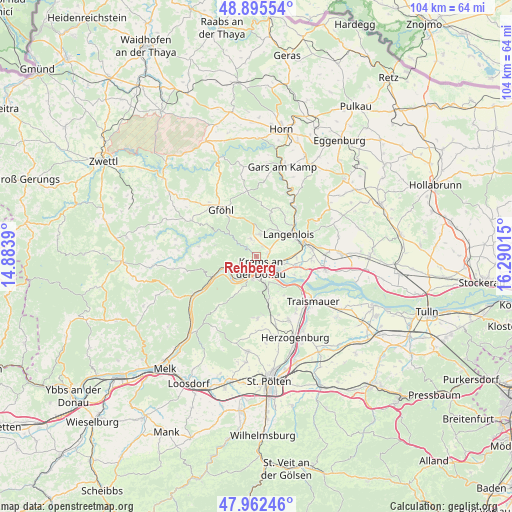
Rehberg GPS coordinates[2]
48° 25' 52.104" North, 15° 35' 13.272" East
| Map corner | latitude | longitude |
|---|---|---|
| Upper-left | 48.89554°, | 14.8839° |
| Center: | 48.43114°, | 15.58702° |
| Lower-right: | 47.96246°, | 16.29015° |
| Map W x H: | 103.7×103.7 km | = 64.4×64.4mi |
| max Lat: | 48.98333° ⇑8.2% North |
| Rehberg: | 48.43114° |
| min Lat: | ⇓91.8% South 46.48841° |
| min Long | Rehberg | max Long |
| 9.57802° | 15.58702° | 17.1° |
| W 68.3%⇐ | ⇒31.7% E |
Elevation
Elevation of Rehberg is 226 m = 741 ft, and this is 279.5 m = 917 ft below average elevation for this country.
| Max E: |
2140 m = 7021 ft | 88.4% |
| Avg. | 505.5 m = 1658 ft | |
| Rehberg | 226 m = 741 ft | |
Min E: |
118 m = 387 ft | 11.6% |
See also: Austria elevation on elevation.city.
Geographical zone
Rehberg is located in North temperate zone (between Tropic of Cancer and the Arctic Circle). Distance of this North polar circle is 2016.1 km =1252.7 mi to North.| Distance of | km | miles | from Rehberg |
|---|---|---|---|
| North Pole | 4622 | 2872 | to North |
| Arctic Circle | 2016.1 | 1252.7 | to North |
| Tropic Cancer | 2779.1 | 1726.9 | to South |
| Equator | 5385 | 3346.1 | to South |


Nearby cities:
15 places around Rehberg: (largest is in red/bold)
• Droß
3.7 km =2.3 mi,  347°
347°
• Egelsee
2.4 km =1.5 mi,  229°
229°
• Gneixendorf
2.4 km =1.5 mi,  72°
72°
• Imbach
2.1 km =1.3 mi, 352°
• Krems an der Donau
3.2 km =2 mi,  140°
140°
• Landersdorf
3.8 km =2.4 mi,  115°
115°
• Lengenfeld
4.6 km =2.9 mi,  10°
10°
• Lerchenfeld
3.9 km =2.4 mi, 122°
• Mautern
4.3 km =2.7 mi,  189°
189°
• Palt
5.5 km =3.4 mi,  159°
159°
• Rohrendorf bei Krems
5.4 km =3.4 mi,  104°
104°
• Senftenberg
2.7 km =1.7 mi,  275°
275°
• Stein an der Donau
3.3 km =2.1 mi, 187°
• Stratzing
2.3 km =1.4 mi,  24°
24°
• Weinzierl bei Krems
3.6 km =2.2 mi, 164°
Sources, notices
• [Note1] Compared only with cities in Austria existing in our database
• [Src1] Map data: © OpenStreetMap contributors (CC-BY-SA)
• [Src2] Other city data from geonames.org with taken over terms of usage.
• [Src3] Geographical zone / Annual Mean Temperature by Robert A. Rohde @ Wikipedia
