Stattersdorf geodata
Stattersdorf (Lower Austria) is a populated place; located in Austria in Europe/Vienna (GMT+2) time zone. With population of 1,963 people, there are 623 cities with bigger population in this country. Compared to other cities in Austria, 77.8% of cities are located further ↓South; 69.9% of cities are located further ←West and 80.4% of cities have higher elevation than Stattersdorf. Note1


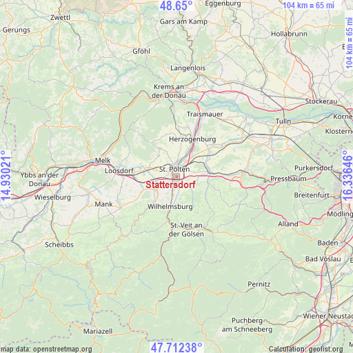
Stattersdorf GPS coordinates[2]
48° 10' 59.988" North, 15° 37' 59.988" East
| Map corner | latitude | longitude |
|---|---|---|
| Upper-left | 48.65°, | 14.93021° |
| Center: | 48.18333°, | 15.63333° |
| Lower-right: | 47.71238°, | 16.33646° |
| Map W x H: | 104.3×104.3 km | = 64.8×64.8mi |
| max Lat: | 48.98333° ⇑22.2% North |
| Stattersdorf: | 48.18333° |
| min Lat: | ⇓77.8% South 46.48841° |
| min Long | Stattersdorf | max Long |
| 9.57802° | 15.63333° | 17.1° |
| W 69.9%⇐ | ⇒30.1% E |
Elevation
Elevation of Stattersdorf is 273 m = 896 ft, and this is 232.5 m = 763 ft below average elevation for this country.
| Max E: |
2140 m = 7021 ft | 80.4% |
| Avg. | 505.5 m = 1658 ft | |
| Stattersdorf | 273 m = 896 ft | |
Min E: |
118 m = 387 ft | 19.6% |
See also: Austria elevation on elevation.city.
Geographical zone
Stattersdorf is located in North temperate zone (between Tropic of Cancer and the Arctic Circle). Distance of this North polar circle is 2043.7 km =1269.9 mi to North.| Distance of | km | miles | from Stattersdorf |
|---|---|---|---|
| North Pole | 4649.6 | 2889.1 | to North |
| Arctic Circle | 2043.7 | 1269.9 | to North |
| Tropic Cancer | 2751.6 | 1709.8 | to South |
| Equator | 5357.5 | 3329 | to South |


Nearby cities:
15 places around Stattersdorf: (largest is in red/bold)
• Eggendorf
5.9 km =3.7 mi,  189°
189°
• Gerersdorf
6 km =3.7 mi,  288°
288°
• Harland
2.4 km =1.5 mi,  171°
171°
• Hart
3.6 km =2.2 mi,  201°
201°
• Mühlgang
4.9 km =3 mi, 195°
• Oberwagram
2.3 km =1.4 mi,  30°
30°
• Pottenbrunn
7.4 km =4.6 mi,  41°
41°
• Pyhra
4.8 km =3 mi,  124°
124°
• Ragelsdorf
6.4 km =4 mi,  1°
1°
• Ratzersdorf an der Traisen
5.4 km =3.4 mi, 27°
• Sankt Pölten
1.9 km =1.2 mi, 0°
• Spratzern
1.8 km =1.1 mi,  217°
217°
• Teufelhof
1.2 km =0.7 mi,  270°
270°
• Unterwagram
3.5 km =2.2 mi,  20°
20°
• Viehofen
3.9 km =2.4 mi,  341°
341°
Sources, notices
• [Note1] Compared only with cities in Austria existing in our database
• [Src1] Map data: © OpenStreetMap contributors (CC-BY-SA)
• [Src2] Other city data from geonames.org with taken over terms of usage.
• [Src3] Geographical zone / Annual Mean Temperature by Robert A. Rohde @ Wikipedia
