Stallhof geodata
Stallhof (Styria) is a seat of a third-order administrative division; located in Austria in Europe/Vienna (GMT+2) time zone. With population of 534 people, there are 2378 cities with bigger population in this country. Compared to other cities in Austria, 88.4% of cities are located further ↑North; 59.7% of cities are located further ←West and 70.2% of cities have higher elevation than Stallhof. Note1
Administrative division(s):
- Level 1: Styria
- Level 2: Politischer Bezirk Deutschlandsberg
- Level 3: Stainz


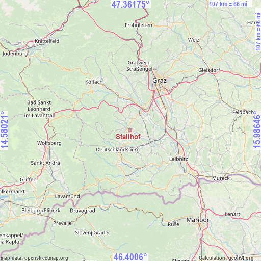
Stallhof GPS coordinates[2]
46° 52' 59.988" North, 15° 16' 59.988" East
| Map corner | latitude | longitude |
|---|---|---|
| Upper-left | 47.36175°, | 14.58021° |
| Center: | 46.88333°, | 15.28333° |
| Lower-right: | 46.4006°, | 15.98646° |
| Map W x H: | 106.9×106.9 km | = 66.4×66.4mi |
| max Lat: | 48.98333° ⇑88.4% North |
| Stallhof: | 46.88333° |
| min Lat: | ⇓11.6% South 46.48841° |
| min Long | Stallhof | max Long |
| 9.57802° | 15.28333° | 17.1° |
| W 59.7%⇐ | ⇒40.3% E |
Elevation
Elevation of Stallhof is 327 m = 1073 ft, and this is 178.5 m = 586 ft below average elevation for this country.
| Max E: |
2140 m = 7021 ft | 70.2% |
| Avg. | 505.5 m = 1658 ft | |
| Stallhof | 327 m = 1073 ft | |
Min E: |
118 m = 387 ft | 29.8% |
See also: Austria elevation on elevation.city.
Geographical zone
Stallhof is located in North temperate zone (between Tropic of Cancer and the Arctic Circle). Distance of this North polar circle is 2188.2 km =1359.7 mi to North.| Distance of | km | miles | from Stallhof |
|---|---|---|---|
| North Pole | 4794.1 | 2978.9 | to North |
| Arctic Circle | 2188.2 | 1359.7 | to North |
| Tropic Cancer | 2607 | 1619.9 | to South |
| Equator | 5212.9 | 3239.1 | to South |


Nearby cities:
15 places around Stallhof: (largest is in red/bold)
• Bad Gams
4.7 km =2.9 mi,  253°
253°
• Blumegg
6.2 km =3.9 mi,  29°
29°
• Freidorf an der Laßnitz
7.8 km =4.8 mi,  198°
198°
• Graschuh
0.7 km =0.4 mi,  255°
255°
• Greisdorf
6.8 km =4.2 mi,  314°
314°
• Groß Sankt Florian
7.1 km =4.4 mi,  157°
157°
• Kothvogel
2.8 km =1.7 mi, 258°
• Lannach
8.1 km =5 mi, 30°
• Lassnitz
7.8 km =4.8 mi, 198°
• Pichling bei Stainz
2.5 km =1.6 mi,  351°
351°
• Rassach
2.8 km =1.7 mi, 201°
• Sankt Josef (Weststeiermark)
5 km =3.1 mi,  54°
54°
• Sankt Stefan ob Stainz
5.4 km =3.4 mi,  339°
339°
• Stainz
1.7 km =1.1 mi,  315°
315°
• Zirknitz
7.5 km =4.7 mi, 346°
Sources, notices
• [Note1] Compared only with cities in Austria existing in our database
• [Src1] Map data: © OpenStreetMap contributors (CC-BY-SA)
• [Src2] Other city data from geonames.org with taken over terms of usage.
• [Src3] Geographical zone / Annual Mean Temperature by Robert A. Rohde @ Wikipedia
