Lannach geodata
Lannach (Styria) is a seat of a third-order administrative division; located in Austria in Europe/Vienna (GMT+2) time zone. With population of 1,334 people, there are 948 cities with bigger population in this country. Compared to other cities in Austria, 86.5% of cities are located further ↑North; 61.3% of cities are located further ←West and 69.5% of cities have higher elevation than Lannach. Note1
Administrative division(s):
- Level 1: Styria
- Level 2: Politischer Bezirk Deutschlandsberg
- Level 3: Lannach


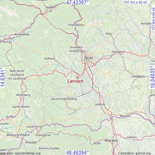
Lannach GPS coordinates[2]
46° 56' 45.996" North, 15° 20' 13.992" East
| Map corner | latitude | longitude |
|---|---|---|
| Upper-left | 47.42397°, | 14.6341° |
| Center: | 46.94611°, | 15.33722° |
| Lower-right: | 46.46394°, | 16.04035° |
| Map W x H: | 106.7×106.7 km | = 66.3×66.3mi |
| max Lat: | 48.98333° ⇑86.5% North |
| Lannach: | 46.94611° |
| min Lat: | ⇓13.5% South 46.48841° |
| min Long | Lannach | max Long |
| 9.57802° | 15.33722° | 17.1° |
| W 61.3%⇐ | ⇒38.7% E |
Elevation
Elevation of Lannach is 330 m = 1083 ft, and this is 175.5 m = 576 ft below average elevation for this country.
| Max E: |
2140 m = 7021 ft | 69.5% |
| Avg. | 505.5 m = 1658 ft | |
| Lannach | 330 m = 1083 ft | |
Min E: |
118 m = 387 ft | 30.5% |
See also: Austria elevation on elevation.city.
Geographical zone
Lannach is located in North temperate zone (between Tropic of Cancer and the Arctic Circle). Distance of this North polar circle is 2181.3 km =1355.4 mi to North.| Distance of | km | miles | from Lannach |
|---|---|---|---|
| North Pole | 4787.1 | 2974.6 | to North |
| Arctic Circle | 2181.3 | 1355.4 | to North |
| Tropic Cancer | 2614 | 1624.3 | to South |
| Equator | 5219.9 | 3243.5 | to South |


Nearby cities:
15 places around Lannach: (largest is in red/bold)
• Blumegg
1.9 km =1.2 mi,  214°
214°
• Dobldorf
2.3 km =1.4 mi,  79°
79°
• Hautzendorf
6.3 km =3.9 mi,  49°
49°
• Laa
6 km =3.7 mi,  85°
85°
• Lieboch
3.1 km =1.9 mi,  0°
0°
• Mooskirchen
5.9 km =3.7 mi,  311°
311°
• Muttendorf
2.6 km =1.6 mi,  122°
122°
• Oberpremstätten
6 km =3.7 mi,  58°
58°
• Pichling bei Stainz
6.4 km =4 mi,  224°
224°
• Sankt Josef (Weststeiermark)
4.1 km =2.5 mi,  180°
180°
• Sankt Stefan ob Stainz
6.3 km =3.9 mi,  251°
251°
• Schadendorf
4.5 km =2.8 mi,  341°
341°
• Spatenhof
2.6 km =1.6 mi,  44°
44°
• Unterpremstätten
5.5 km =3.4 mi,  67°
67°
• Zirknitz
5.8 km =3.6 mi,  273°
273°
Sources, notices
• [Note1] Compared only with cities in Austria existing in our database
• [Src1] Map data: © OpenStreetMap contributors (CC-BY-SA)
• [Src2] Other city data from geonames.org with taken over terms of usage.
• [Src3] Geographical zone / Annual Mean Temperature by Robert A. Rohde @ Wikipedia
