Lassnitz geodata
Lassnitz (Styria) is a populated place; located in Austria in Europe/Vienna (GMT+2) time zone. With population of 966 people, there are 1341 cities with bigger population in this country. Compared to other cities in Austria, 91.1% of cities are located further ↑North; 58.7% of cities are located further ←West and 67.3% of cities have higher elevation than Lassnitz. Note1
Administrative division(s):
- Level 1: Styria
- Level 2: Politischer Bezirk Deutschlandsberg
- Level 3: Frauental an der Laßnitz


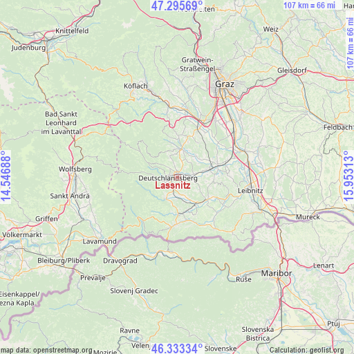
Lassnitz GPS coordinates[2]
46° 49' 0.012" North, 15° 15' 0" East
| Map corner | latitude | longitude |
|---|---|---|
| Upper-left | 47.29569°, | 14.54688° |
| Center: | 46.81667°, | 15.25° |
| Lower-right: | 46.33334°, | 15.95313° |
| Map W x H: | 107×107 km | = 66.5×66.5mi |
| max Lat: | 48.98333° ⇑91.1% North |
| Lassnitz: | 46.81667° |
| min Lat: | ⇓8.9% South 46.48841° |
| min Long | Lassnitz | max Long |
| 9.57802° | 15.25° | 17.1° |
| W 58.7%⇐ | ⇒41.3% E |
Elevation
Elevation of Lassnitz is 341 m = 1119 ft, and this is 164.5 m = 540 ft below average elevation for this country.
| Max E: |
2140 m = 7021 ft | 67.3% |
| Avg. | 505.5 m = 1658 ft | |
| Lassnitz | 341 m = 1119 ft | |
Min E: |
118 m = 387 ft | 32.7% |
See also: Austria elevation on elevation.city.
Geographical zone
Lassnitz is located in North temperate zone (between Tropic of Cancer and the Arctic Circle). Distance of this North polar circle is 2195.6 km =1364.3 mi to North.| Distance of | km | miles | from Lassnitz |
|---|---|---|---|
| North Pole | 4801.5 | 2983.5 | to North |
| Arctic Circle | 2195.6 | 1364.3 | to North |
| Tropic Cancer | 2599.6 | 1615.3 | to South |
| Equator | 5205.5 | 3234.5 | to South |


Nearby cities:
15 places around Lassnitz: (largest is in red/bold)
• Bad Gams
6.4 km =4 mi,  342°
342°
• Deutschlandsberg
2.1 km =1.3 mi,  265°
265°
• Freidorf an der Laßnitz
0 km =0 mi,  0°
0°
• Graschuh
7.5 km =4.7 mi,  14°
14°
• Groß Sankt Florian
5.3 km =3.3 mi,  80°
80°
• Hollenegg
3.9 km =2.4 mi,  224°
224°
• Kothvogel
6.9 km =4.3 mi,  358°
358°
• Mainsdorf
8.4 km =5.2 mi,  228°
228°
• Rassach
5.1 km =3.2 mi,  17°
17°
• Sankt Martin im Sulmtal
7.6 km =4.7 mi,  151°
151°
• Sankt Peter im Sulmtal
7.4 km =4.6 mi,  180°
180°
• Schwanberg
7.2 km =4.5 mi,  206°
206°
• Stallhof
7.8 km =4.8 mi, 18°
• Trahütten
7.1 km =4.4 mi,  277°
277°
• Unterbergla
5.1 km =3.2 mi,  101°
101°
Sources, notices
• [Note1] Compared only with cities in Austria existing in our database
• [Src1] Map data: © OpenStreetMap contributors (CC-BY-SA)
• [Src2] Other city data from geonames.org with taken over terms of usage.
• [Src3] Geographical zone / Annual Mean Temperature by Robert A. Rohde @ Wikipedia
