Stadtschlaining geodata
Stadtschlaining (Burgenland) is a seat of a third-order administrative division; located in Austria in Europe/Vienna (GMT+2) time zone. With population of 668 people, there are 1940 cities with bigger population in this country. Compared to other cities in Austria, 64.5% of cities are located further ↑North; 88.2% of cities are located further ←West and 66.8% of cities have higher elevation than Stadtschlaining. Note1
Administrative division(s):
- Level 1: Burgenland
- Level 2: Politischer Bezirk Oberwart
- Level 3: Stadtschlaining


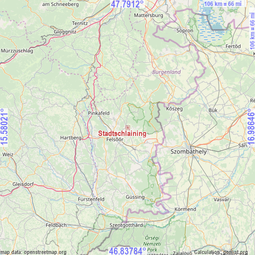
Stadtschlaining GPS coordinates[2]
47° 19' 0.012" North, 16° 16' 59.988" East
| Map corner | latitude | longitude |
|---|---|---|
| Upper-left | 47.7912°, | 15.58021° |
| Center: | 47.31667°, | 16.28333° |
| Lower-right: | 46.83784°, | 16.98646° |
| Map W x H: | 106×106 km | = 65.9×65.9mi |
| max Lat: | 48.98333° ⇑64.5% North |
| Stadtschlaining: | 47.31667° |
| min Lat: | ⇓35.5% South 46.48841° |
| min Long | Stadtschlaining | max Long |
| 9.57802° | 16.28333° | 17.1° |
| W 88.2%⇐ | ⇒11.8% E |
Elevation
Elevation of Stadtschlaining is 343 m = 1125 ft, and this is 162.5 m = 533 ft below average elevation for this country.
| Max E: |
2140 m = 7021 ft | 66.8% |
| Avg. | 505.5 m = 1658 ft | |
| Stadtschlaining | 343 m = 1125 ft | |
Min E: |
118 m = 387 ft | 33.2% |
See also: Austria elevation on elevation.city.
Geographical zone
Stadtschlaining is located in North temperate zone (between Tropic of Cancer and the Arctic Circle). Distance of this North polar circle is 2140.1 km =1329.8 mi to North.| Distance of | km | miles | from Stadtschlaining |
|---|---|---|---|
| North Pole | 4745.9 | 2949 | to North |
| Arctic Circle | 2140.1 | 1329.8 | to North |
| Tropic Cancer | 2655.2 | 1649.9 | to South |
| Equator | 5261.1 | 3269.1 | to South |


Nearby cities:
15 places around Stadtschlaining: (largest is in red/bold)
• Bad Tatzmannsdorf
4.3 km =2.7 mi,  292°
292°
• Bernstein
9.6 km =6 mi,  344°
344°
• Grosspetersdorf
9 km =5.6 mi,  163°
163°
• Jabing
8.7 km =5.4 mi,  183°
183°
• Jormannsdorf
6.2 km =3.9 mi,  306°
306°
• Mariasdorf
6.7 km =4.2 mi,  324°
324°
• Markt Neuhodis
8.8 km =5.5 mi,  105°
105°
• Oberschützen
6.9 km =4.3 mi,  303°
303°
• Oberwart
6.6 km =4.1 mi,  242°
242°
• Rechnitz
12 km =7.5 mi,  96°
96°
• Riedlingsdorf
11.9 km =7.4 mi, 288°
• Rotenturm an der Pinka
7.8 km =4.8 mi,  198°
198°
• Unterkohlstätten
7.8 km =4.8 mi,  18°
18°
• Unterwart
8.3 km =5.2 mi,  206°
206°
• Weiden bei Rechnitz
5.4 km =3.4 mi, 110°
Sources, notices
• [Note1] Compared only with cities in Austria existing in our database
• [Src1] Map data: © OpenStreetMap contributors (CC-BY-SA)
• [Src2] Other city data from geonames.org with taken over terms of usage.
• [Src3] Geographical zone / Annual Mean Temperature by Robert A. Rohde @ Wikipedia
