Oberwart geodata
Oberwart (Burgenland) is a seat of a second-order administrative division; located in Austria in Europe/Vienna (GMT+2) time zone. With population of 7,288 people, there are 127 cities with bigger population in this country. Compared to other cities in Austria, 66.2% of cities are located further ↑North; 86.1% of cities are located further ←West and 72.6% of cities have higher elevation than Oberwart. Note1
Administrative division(s):
- Level 1: Burgenland
- Level 2: Politischer Bezirk Oberwart
- Level 3: Oberwart


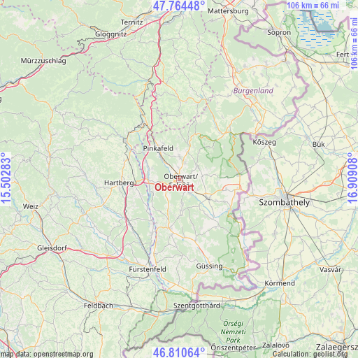
Oberwart GPS coordinates[2]
47° 17' 22.956" North, 16° 12' 21.42" East
| Map corner | latitude | longitude |
|---|---|---|
| Upper-left | 47.76448°, | 15.50283° |
| Center: | 47.28971°, | 16.20595° |
| Lower-right: | 46.81064°, | 16.90908° |
| Map W x H: | 106.1×106.1 km | = 65.9×65.9mi |
| max Lat: | 48.98333° ⇑66.2% North |
| Oberwart: | 47.28971° |
| min Lat: | ⇓33.8% South 46.48841° |
| min Long | Oberwart | max Long |
| 9.57802° | 16.20595° | 17.1° |
| W 86.1%⇐ | ⇒13.9% E |
Elevation
Elevation of Oberwart is 316 m = 1037 ft, and this is 189.5 m = 622 ft below average elevation for this country.
| Max E: |
2140 m = 7021 ft | 72.6% |
| Avg. | 505.5 m = 1658 ft | |
| Oberwart | 316 m = 1037 ft | |
Min E: |
118 m = 387 ft | 27.4% |
See also: Austria elevation on elevation.city.
Geographical zone
Oberwart is located in North temperate zone (between Tropic of Cancer and the Arctic Circle). Distance of this North polar circle is 2143.1 km =1331.7 mi to North.| Distance of | km | miles | from Oberwart |
|---|---|---|---|
| North Pole | 4748.9 | 2950.8 | to North |
| Arctic Circle | 2143.1 | 1331.7 | to North |
| Tropic Cancer | 2652.2 | 1648 | to South |
| Equator | 5258.1 | 3267.2 | to South |


Nearby cities:
15 places around Oberwart: (largest is in red/bold)
• Bad Tatzmannsdorf
5 km =3.1 mi,  21°
21°
• Buchschachen
8.5 km =5.3 mi,  290°
290°
• Jabing
7.8 km =4.8 mi,  136°
136°
• Jormannsdorf
6.8 km =4.2 mi,  6°
6°
• Kemeten
6.1 km =3.8 mi,  221°
221°
• Litzelsdorf
9.4 km =5.8 mi,  195°
195°
• Mariasdorf
8.7 km =5.4 mi, 12°
• Markt Allhau
9.3 km =5.8 mi,  265°
265°
• Oberdorf im Burgenland
8.2 km =5.1 mi,  174°
174°
• Oberschützen
6.9 km =4.3 mi,  0°
0°
• Riedlingsdorf
8.7 km =5.4 mi,  320°
320°
• Rotenturm an der Pinka
5.5 km =3.4 mi, 143°
• Stadtschlaining
6.6 km =4.1 mi,  62°
62°
• Unterwart
4.9 km =3 mi,  154°
154°
• Wolfau
9.1 km =5.7 mi,  241°
241°
Sources, notices
• [Note1] Compared only with cities in Austria existing in our database
• [Src1] Map data: © OpenStreetMap contributors (CC-BY-SA)
• [Src2] Other city data from geonames.org with taken over terms of usage.
• [Src3] Geographical zone / Annual Mean Temperature by Robert A. Rohde @ Wikipedia
