Jormannsdorf geodata
Jormannsdorf (Burgenland) is a populated place; located in Austria in Europe/Vienna (GMT+2) time zone. With population of 704 people, there are 1846 cities with bigger population in this country. Compared to other cities in Austria, 62.8% of cities are located further ↑North; 86.5% of cities are located further ←West and 55.9% of cities have higher elevation than Jormannsdorf. Note1
Administrative division(s):
- Level 1: Burgenland
- Level 2: Politischer Bezirk Oberwart
- Level 3: Bad Tatzmannsdorf


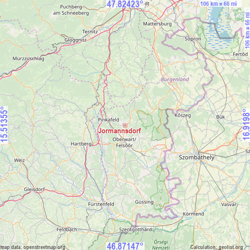
Jormannsdorf GPS coordinates[2]
47° 21' 0" North, 16° 13' 0.012" East
| Map corner | latitude | longitude |
|---|---|---|
| Upper-left | 47.82423°, | 15.51355° |
| Center: | 47.35°, | 16.21667° |
| Lower-right: | 46.87147°, | 16.9198° |
| Map W x H: | 105.9×105.9 km | = 65.8×65.8mi |
| max Lat: | 48.98333° ⇑62.8% North |
| Jormannsdorf: | 47.35° |
| min Lat: | ⇓37.2% South 46.48841° |
| min Long | Jormannsdorf | max Long |
| 9.57802° | 16.21667° | 17.1° |
| W 86.5%⇐ | ⇒13.5% E |
Elevation
Elevation of Jormannsdorf is 413 m = 1355 ft, and this is 92.5 m = 303 ft below average elevation for this country.
| Max E: |
2140 m = 7021 ft | 55.9% |
| Avg. | 505.5 m = 1658 ft | |
| Jormannsdorf | 413 m = 1355 ft | |
Min E: |
118 m = 387 ft | 44.1% |
See also: Austria elevation on elevation.city.
Geographical zone
Jormannsdorf is located in North temperate zone (between Tropic of Cancer and the Arctic Circle). Distance of this North polar circle is 2136.3 km =1327.4 mi to North.| Distance of | km | miles | from Jormannsdorf |
|---|---|---|---|
| North Pole | 4742.2 | 2946.7 | to North |
| Arctic Circle | 2136.3 | 1327.4 | to North |
| Tropic Cancer | 2658.9 | 1652.2 | to South |
| Equator | 5264.8 | 3271.4 | to South |


Nearby cities:
15 places around Jormannsdorf: (largest is in red/bold)
• Bad Tatzmannsdorf
2.3 km =1.4 mi,  153°
153°
• Bernstein
6.1 km =3.8 mi,  24°
24°
• Buchschachen
9.5 km =5.9 mi,  247°
247°
• Grafenschachen
11.4 km =7.1 mi,  279°
279°
• Loipersdorf im Burgenland
10.2 km =6.3 mi,  259°
259°
• Mariasdorf
2.1 km =1.3 mi,  32°
32°
• Oberschützen
0.7 km =0.4 mi, 282°
• Oberwart
6.8 km =4.2 mi,  186°
186°
• Pinkafeld
7.8 km =4.8 mi, 283°
• Riedlingsdorf
6.3 km =3.9 mi,  270°
270°
• Rotenturm an der Pinka
11.4 km =7.1 mi,  167°
167°
• Stadtschlaining
6.2 km =3.9 mi,  126°
126°
• Unterkohlstätten
8.4 km =5.2 mi,  63°
63°
• Unterwart
11.2 km =7 mi, 173°
• Wiesfleck
6.6 km =4.1 mi,  305°
305°
Sources, notices
• [Note1] Compared only with cities in Austria existing in our database
• [Src1] Map data: © OpenStreetMap contributors (CC-BY-SA)
• [Src2] Other city data from geonames.org with taken over terms of usage.
• [Src3] Geographical zone / Annual Mean Temperature by Robert A. Rohde @ Wikipedia
