Schwendt geodata
Schwendt (Tyrol) is a seat of a third-order administrative division; located in Austria in Europe/Vienna (GMT+2) time zone. With population of 823 people, there are 1571 cities with bigger population in this country. Compared to other cities in Austria, 51.3% of cities are located further ↓South; 86.7% of cities are located further →East and 79.5% of cities have lower elevation than Schwendt. Note1


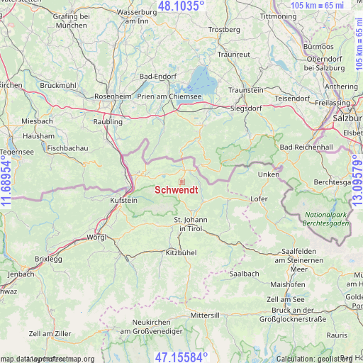
Schwendt GPS coordinates[2]
47° 37' 54.552" North, 12° 23' 33.576" East
| Map corner | latitude | longitude |
|---|---|---|
| Upper-left | 48.1035°, | 11.68954° |
| Center: | 47.63182°, | 12.39266° |
| Lower-right: | 47.15584°, | 13.09579° |
| Map W x H: | 105.4×105.4 km | = 65.5×65.5mi |
| max Lat: | 48.98333° ⇑48.7% North |
| Schwendt: | 47.63182° |
| min Lat: | ⇓51.3% South 46.48841° |
| min Long | Schwendt | max Long |
| 9.57802° | 12.39266° | 17.1° |
| W 13.3%⇐ | ⇒86.7% E |
Elevation
Elevation of Schwendt is 706 m = 2316 ft, and this is 200.5 m = 658 ft above average elevation for this country.
| Max E: |
2140 m = 7021 ft | 20.5% |
| Schwendt | 706 m 2316 ft | |
| Avg. | 505.5 m = 1658 ft | |
Min E: |
118 m = 387 ft | 79.5% |
See also: Austria elevation on elevation.city.
Geographical zone
Schwendt is located in North temperate zone (between Tropic of Cancer and the Arctic Circle). Distance of this North polar circle is 2105 km =1308 mi to North.| Distance of | km | miles | from Schwendt |
|---|---|---|---|
| North Pole | 4710.9 | 2927.2 | to North |
| Arctic Circle | 2105 | 1308 | to North |
| Tropic Cancer | 2690.2 | 1671.6 | to South |
| Equator | 5296.2 | 3290.9 | to South |


Nearby cities:
15 places around Schwendt: (largest is in red/bold)
• Durchholzen
8.2 km =5.1 mi,  271°
271°
• Ebbs
13.2 km =8.2 mi, 270°
• Ellmau
14.9 km =9.3 mi,  208°
208°
• Erpfendorf
7.7 km =4.8 mi,  134°
134°
• Going
13.9 km =8.6 mi,  199°
199°
• Kirchdorf in Tirol
9.3 km =5.8 mi,  154°
154°
• Kössen
4.3 km =2.7 mi,  12°
12°
• Niederndorf
13.3 km =8.3 mi,  278°
278°
• Oberndorf
13.3 km =8.3 mi,  262°
262°
• Oberndorf in Tirol
14.7 km =9.1 mi,  182°
182°
• Rettenschöss
9.7 km =6 mi,  286°
286°
• Sankt Johann in Tirol
12.3 km =7.6 mi,  169°
169°
• Sonnseite
13.8 km =8.6 mi, 206°
• Waidring
14.1 km =8.8 mi,  112°
112°
• Walchsee
6 km =3.7 mi, 291°
Sources, notices
• [Note1] Compared only with cities in Austria existing in our database
• [Src1] Map data: © OpenStreetMap contributors (CC-BY-SA)
• [Src2] Other city data from geonames.org with taken over terms of usage.
• [Src3] Geographical zone / Annual Mean Temperature by Robert A. Rohde @ Wikipedia
