Rettenschöss geodata
Rettenschöss (Tyrol) is a seat of a third-order administrative division; located in Austria in Europe/Vienna (GMT+2) time zone. With population of 513 people, there are 2458 cities with bigger population in this country. Compared to other cities in Austria, 52.2% of cities are located further ↓South; 87.2% of cities are located further →East and 77.1% of cities have lower elevation than Rettenschöss. Note1
Administrative division(s):
- Level 1: Tyrol
- Level 2: Politischer Bezirk Kufstein
- Level 3: Rettenschöss


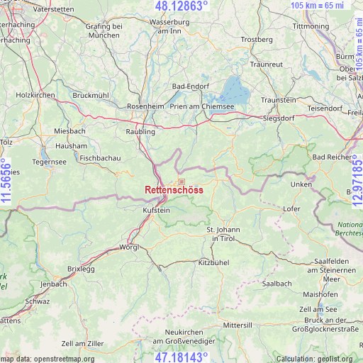
Rettenschöss GPS coordinates[2]
47° 39' 25.848" North, 12° 16' 7.392" East
| Map corner | latitude | longitude |
|---|---|---|
| Upper-left | 48.12863°, | 11.5656° |
| Center: | 47.65718°, | 12.26872° |
| Lower-right: | 47.18143°, | 12.97185° |
| Map W x H: | 105.3×105.3 km | = 65.4×65.4mi |
| max Lat: | 48.98333° ⇑47.8% North |
| Rettenschöss: | 47.65718° |
| min Lat: | ⇓52.2% South 46.48841° |
| min Long | Rettenschöss | max Long |
| 9.57802° | 12.26872° | 17.1° |
| W 12.8%⇐ | ⇒87.2% E |
Elevation
Elevation of Rettenschöss is 676 m = 2218 ft, and this is 170.5 m = 559 ft above average elevation for this country.
| Max E: |
2140 m = 7021 ft | 22.9% |
| Rettenschöss | 676 m 2218 ft | |
| Avg. | 505.5 m = 1658 ft | |
Min E: |
118 m = 387 ft | 77.1% |
See also: Austria elevation on elevation.city.
Geographical zone
Rettenschöss is located in North temperate zone (between Tropic of Cancer and the Arctic Circle). Distance of this North polar circle is 2102.2 km =1306.2 mi to North.| Distance of | km | miles | from Rettenschöss |
|---|---|---|---|
| North Pole | 4708.1 | 2925.5 | to North |
| Arctic Circle | 2102.2 | 1306.2 | to North |
| Tropic Cancer | 2693.1 | 1673.4 | to South |
| Equator | 5299 | 3292.6 | to South |


Nearby cities:
15 places around Rettenschöss: (largest is in red/bold)
• Durchholzen
2.9 km =1.8 mi,  157°
157°
• Ebbs
4.7 km =2.9 mi,  235°
235°
• Eichelwang
8.9 km =5.5 mi,  223°
223°
• Endach
13 km =8.1 mi, 220°
• Erl
7 km =4.3 mi,  294°
294°
• Kufstein
11.2 km =7 mi, 222°
• Kössen
10.3 km =6.4 mi,  82°
82°
• Mitterndorf
11.6 km =7.2 mi, 219°
• Mühlgraben
6.5 km =4 mi,  279°
279°
• Niederndorf
4 km =2.5 mi,  258°
258°
• Oberndorf
6 km =3.7 mi, 220°
• Schwendt
9.7 km =6 mi,  106°
106°
• Walchsee
3.8 km =2.4 mi,  99°
99°
• Weissach
12.5 km =7.8 mi, 219°
• Zell
12.1 km =7.5 mi,  227°
227°
Sources, notices
• [Note1] Compared only with cities in Austria existing in our database
• [Src1] Map data: © OpenStreetMap contributors (CC-BY-SA)
• [Src2] Other city data from geonames.org with taken over terms of usage.
• [Src3] Geographical zone / Annual Mean Temperature by Robert A. Rohde @ Wikipedia
