Niederndorf geodata
Niederndorf (Tyrol) is a seat of a third-order administrative division; located in Austria in Europe/Vienna (GMT+2) time zone. With population of 2,736 people, there are 426 cities with bigger population in this country. Compared to other cities in Austria, 51.9% of cities are located further ↓South; 87.4% of cities are located further →East and 57% of cities have lower elevation than Niederndorf. Note1
Administrative division(s):
- Level 1: Tyrol
- Level 2: Politischer Bezirk Kufstein
- Level 3: Niederndorf


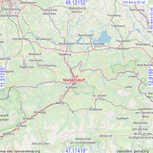
Niederndorf GPS coordinates[2]
47° 39' 0" North, 12° 13' 0.012" East
| Map corner | latitude | longitude |
|---|---|---|
| Upper-left | 48.12152°, | 11.51355° |
| Center: | 47.65°, | 12.21667° |
| Lower-right: | 47.17419°, | 12.9198° |
| Map W x H: | 105.3×105.3 km | = 65.4×65.4mi |
| max Lat: | 48.98333° ⇑48.1% North |
| Niederndorf: | 47.65° |
| min Lat: | ⇓51.9% South 46.48841° |
| min Long | Niederndorf | max Long |
| 9.57802° | 12.21667° | 17.1° |
| W 12.6%⇐ | ⇒87.4% E |
Elevation
Elevation of Niederndorf is 498 m = 1634 ft, and this is 7.5 m = 25 ft below average elevation for this country.
| Max E: |
2140 m = 7021 ft | 43% |
| Avg. | 505.5 m = 1658 ft | |
| Niederndorf | 498 m = 1634 ft | |
Min E: |
118 m = 387 ft | 57% |
See also: Austria elevation on elevation.city.
Geographical zone
Niederndorf is located in North temperate zone (between Tropic of Cancer and the Arctic Circle). Distance of this North polar circle is 2103 km =1306.7 mi to North.| Distance of | km | miles | from Niederndorf |
|---|---|---|---|
| North Pole | 4708.9 | 2926 | to North |
| Arctic Circle | 2103 | 1306.7 | to North |
| Tropic Cancer | 2692.3 | 1672.9 | to South |
| Equator | 5298.2 | 3292.1 | to South |


Nearby cities:
15 places around Niederndorf: (largest is in red/bold)
• Durchholzen
5.3 km =3.3 mi,  110°
110°
• Ebbs
1.9 km =1.2 mi,  180°
180°
• Eichelwang
6.1 km =3.8 mi,  202°
202°
• Endach
10.2 km =6.3 mi,  206°
206°
• Erl
4.5 km =2.8 mi,  326°
326°
• Kufstein
8.3 km =5.2 mi, 206°
• Mitterland
11.4 km =7.1 mi,  232°
232°
• Mitterndorf
8.8 km =5.5 mi, 203°
• Mühlgraben
3.1 km =1.9 mi,  306°
306°
• Oberndorf
3.7 km =2.3 mi, 180°
• Rettenschöss
4 km =2.5 mi,  78°
78°
• Thiersee
9.7 km =6 mi, 230°
• Walchsee
7.6 km =4.7 mi,  88°
88°
• Weissach
9.7 km =6 mi, 204°
• Zell
8.9 km =5.5 mi, 213°
Sources, notices
• [Note1] Compared only with cities in Austria existing in our database
• [Src1] Map data: © OpenStreetMap contributors (CC-BY-SA)
• [Src2] Other city data from geonames.org with taken over terms of usage.
• [Src3] Geographical zone / Annual Mean Temperature by Robert A. Rohde @ Wikipedia
