Kössen geodata
Kössen (Tyrol) is a seat of a third-order administrative division; located in Austria in Europe/Vienna (GMT+2) time zone. With population of 4,346 people, there are 229 cities with bigger population in this country. Compared to other cities in Austria, 52.6% of cities are located further ↓South; 86.6% of cities are located further →East and 70.1% of cities have lower elevation than Kössen. Note1


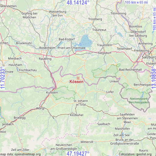
Kössen GPS coordinates[2]
47° 40' 11.64" North, 12° 24' 19.62" East
| Map corner | latitude | longitude |
|---|---|---|
| Upper-left | 48.14124°, | 11.70233° |
| Center: | 47.6699°, | 12.40545° |
| Lower-right: | 47.19427°, | 13.10858° |
| Map W x H: | 105.3×105.3 km | = 65.4×65.4mi |
| max Lat: | 48.98333° ⇑47.4% North |
| Kössen: | 47.6699° |
| min Lat: | ⇓52.6% South 46.48841° |
| min Long | Kössen | max Long |
| 9.57802° | 12.40545° | 17.1° |
| W 13.4%⇐ | ⇒86.6% E |
Elevation
Elevation of Kössen is 589 m = 1932 ft, and this is 83.5 m = 274 ft above average elevation for this country.
| Max E: |
2140 m = 7021 ft | 29.9% |
| Kössen | 589 m 1932 ft | |
| Avg. | 505.5 m = 1658 ft | |
Min E: |
118 m = 387 ft | 70.1% |
See also: Austria elevation on elevation.city.
Geographical zone
Kössen is located in North temperate zone (between Tropic of Cancer and the Arctic Circle). Distance of this North polar circle is 2100.8 km =1305.4 mi to North.| Distance of | km | miles | from Kössen |
|---|---|---|---|
| North Pole | 4706.7 | 2924.6 | to North |
| Arctic Circle | 2100.8 | 1305.4 | to North |
| Tropic Cancer | 2694.5 | 1674.3 | to South |
| Equator | 5300.4 | 3293.5 | to South |


Nearby cities:
15 places around Kössen: (largest is in red/bold)
• Durchholzen
10 km =6.2 mi,  246°
246°
• Ebbs
14.7 km =9.1 mi, 253°
• Eichelwang
18.2 km =11.3 mi,  244°
244°
• Erl
16.7 km =10.4 mi,  275°
275°
• Erpfendorf
10.7 km =6.6 mi,  154°
154°
• Kirchdorf in Tirol
13 km =8.1 mi,  166°
166°
• Mühlgraben
16.6 km =10.3 mi,  268°
268°
• Niederndorf
14.3 km =8.9 mi,  261°
261°
• Oberndorf
15.3 km =9.5 mi, 247°
• Rettenschöss
10.3 km =6.4 mi, 262°
• Sankt Johann in Tirol
16.4 km =10.2 mi,  175°
175°
• Schwendt
4.3 km =2.7 mi,  192°
192°
• Sonnseite
18.1 km =11.2 mi,  203°
203°
• Waidring
15.4 km =9.6 mi,  128°
128°
• Walchsee
6.8 km =4.2 mi, 252°
Sources, notices
• [Note1] Compared only with cities in Austria existing in our database
• [Src1] Map data: © OpenStreetMap contributors (CC-BY-SA)
• [Src2] Other city data from geonames.org with taken over terms of usage.
• [Src3] Geographical zone / Annual Mean Temperature by Robert A. Rohde @ Wikipedia
