Erpfendorf geodata
Erpfendorf (Tyrol) is a populated place; located in Austria in Europe/Vienna (GMT+2) time zone. With population of 1,141 people, there are 1112 cities with bigger population in this country. Compared to other cities in Austria, 50.4% of cities are located further ↑North; 86.3% of cities are located further →East and 85.8% of cities have lower elevation than Erpfendorf. Note1
Administrative division(s):
- Level 1: Tyrol
- Level 2: Politischer Bezirk Kitzbühel
- Level 3: Kirchdorf in Tirol


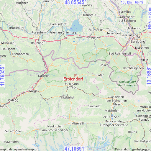
Erpfendorf GPS coordinates[2]
47° 34' 59.988" North, 12° 28' 0.012" East
| Map corner | latitude | longitude |
|---|---|---|
| Upper-left | 48.05545°, | 11.76355° |
| Center: | 47.58333°, | 12.46667° |
| Lower-right: | 47.10691°, | 13.1698° |
| Map W x H: | 105.5×105.5 km | = 65.6×65.6mi |
| max Lat: | 48.98333° ⇑50.4% North |
| Erpfendorf: | 47.58333° |
| min Lat: | ⇓49.6% South 46.48841° |
| min Long | Erpfendorf | max Long |
| 9.57802° | 12.46667° | 17.1° |
| W 13.7%⇐ | ⇒86.3% E |
Elevation
Elevation of Erpfendorf is 808 m = 2651 ft, and this is 302.5 m = 992 ft above average elevation for this country.
| Max E: |
2140 m = 7021 ft | 14.2% |
| Erpfendorf | 808 m 2651 ft | |
| Avg. | 505.5 m = 1658 ft | |
Min E: |
118 m = 387 ft | 85.8% |
See also: Austria elevation on elevation.city.
Geographical zone
Erpfendorf is located in North temperate zone (between Tropic of Cancer and the Arctic Circle). Distance of this North polar circle is 2110.4 km =1311.3 mi to North.| Distance of | km | miles | from Erpfendorf |
|---|---|---|---|
| North Pole | 4716.3 | 2930.6 | to North |
| Arctic Circle | 2110.4 | 1311.3 | to North |
| Tropic Cancer | 2684.9 | 1668.3 | to South |
| Equator | 5290.8 | 3287.5 | to South |


Nearby cities:
15 places around Erpfendorf: (largest is in red/bold)
• Durchholzen
14.8 km =9.2 mi,  292°
292°
• Ellmau
14.7 km =9.1 mi,  238°
238°
• Fieberbrunn
13.2 km =8.2 mi,  154°
154°
• Going
12.8 km =8 mi,  232°
232°
• Kirchdorf in Tirol
3.4 km =2.1 mi,  208°
208°
• Kössen
10.7 km =6.6 mi,  334°
334°
• Oberndorf in Tirol
11.2 km =7 mi, 214°
• Reith bei Kitzbühel
15.7 km =9.8 mi, 214°
• Sankt Jakob in Haus
11.2 km =7 mi, 145°
• Sankt Johann in Tirol
7.4 km =4.6 mi, 206°
• Sankt Ulrich am Pillersee
10.1 km =6.3 mi,  128°
128°
• Schwendt
7.7 km =4.8 mi,  314°
314°
• Sonnseite
13.6 km =8.5 mi, 238°
• Waidring
7.5 km =4.7 mi,  90°
90°
• Walchsee
13.4 km =8.3 mi,  304°
304°
Sources, notices
• [Note1] Compared only with cities in Austria existing in our database
• [Src1] Map data: © OpenStreetMap contributors (CC-BY-SA)
• [Src2] Other city data from geonames.org with taken over terms of usage.
• [Src3] Geographical zone / Annual Mean Temperature by Robert A. Rohde @ Wikipedia
