Schrattenbach geodata
Schrattenbach (Lower Austria) is a seat of a third-order administrative division; located in Austria in Europe/Vienna (GMT+2) time zone. With population of 45 people, there are 2941 cities with bigger population in this country. Compared to other cities in Austria, 56.3% of cities are located further ↓South; 80% of cities are located further ←West and 65.6% of cities have lower elevation than Schrattenbach. Note1
Administrative division(s):
- Level 1: Lower Austria
- Level 2: Politischer Bezirk Neunkirchen
- Level 3: Schrattenbach


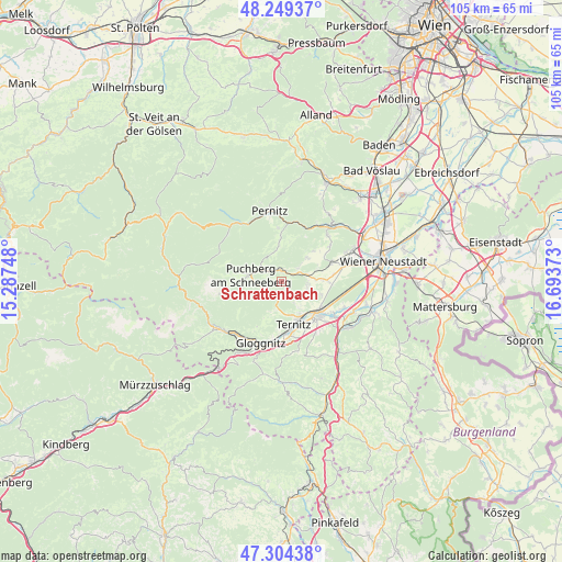
Schrattenbach GPS coordinates[2]
47° 46' 44.472" North, 15° 59' 26.16" East
| Map corner | latitude | longitude |
|---|---|---|
| Upper-left | 48.24937°, | 15.28748° |
| Center: | 47.77902°, | 15.9906° |
| Lower-right: | 47.30438°, | 16.69373° |
| Map W x H: | 105.1×105.1 km | = 65.3×65.3mi |
| max Lat: | 48.98333° ⇑43.7% North |
| Schrattenbach: | 47.77902° |
| min Lat: | ⇓56.3% South 46.48841° |
| min Long | Schrattenbach | max Long |
| 9.57802° | 15.9906° | 17.1° |
| W 80%⇐ | ⇒20% E |
Elevation
Elevation of Schrattenbach is 556 m = 1824 ft, and this is 50.5 m = 166 ft above average elevation for this country.
| Max E: |
2140 m = 7021 ft | 34.4% |
| Schrattenbach | 556 m 1824 ft | |
| Avg. | 505.5 m = 1658 ft | |
Min E: |
118 m = 387 ft | 65.6% |
See also: Austria elevation on elevation.city.
Geographical zone
Schrattenbach is located in North temperate zone (between Tropic of Cancer and the Arctic Circle). Distance of this North polar circle is 2088.6 km =1297.8 mi to North.| Distance of | km | miles | from Schrattenbach |
|---|---|---|---|
| North Pole | 4694.5 | 2917 | to North |
| Arctic Circle | 2088.6 | 1297.8 | to North |
| Tropic Cancer | 2706.6 | 1681.8 | to South |
| Equator | 5312.5 | 3301 | to South |


Nearby cities:
15 places around Schrattenbach: (largest is in red/bold)
• Buchbach
9.2 km =5.7 mi,  182°
182°
• Grünbach am Schneeberg
2.1 km =1.3 mi,  354°
354°
• Maiersdorf
6.5 km =4 mi,  47°
47°
• Miesenbach
6.8 km =4.2 mi, 354°
• Mollram
7.8 km =4.8 mi,  106°
106°
• Neunkirchen
9.3 km =5.8 mi,  133°
133°
• Pottschach
9 km =5.6 mi,  172°
172°
• Puchberg am Schneeberg
5.8 km =3.6 mi,  278°
278°
• Raglitz
5.5 km =3.4 mi, 126°
• Saubersdorf
9.6 km =6 mi,  83°
83°
• Stollhof
8.2 km =5.1 mi, 46°
• Ternitz
7.8 km =4.8 mi,  154°
154°
• Willendorf am Steinfelde
5.1 km =3.2 mi, 77°
• Wimpassing im Schwarzatale
9 km =5.6 mi,  159°
159°
• Würflach
4.8 km =3 mi,  93°
93°
Sources, notices
• [Note1] Compared only with cities in Austria existing in our database
• [Src1] Map data: © OpenStreetMap contributors (CC-BY-SA)
• [Src2] Other city data from geonames.org with taken over terms of usage.
• [Src3] Geographical zone / Annual Mean Temperature by Robert A. Rohde @ Wikipedia
