Bad Leonfelden geodata
Bad Leonfelden (Upper Austria) is a seat of a third-order administrative division; located in Austria in Europe/Vienna (GMT+2) time zone. With population of 288 people, there are 2764 cities with bigger population in this country. Compared to other cities in Austria, 94.8% of cities are located further ↓South; 58% of cities are located further →East and 81.6% of cities have lower elevation than Bad Leonfelden. Note1
Administrative division(s):
- Level 1: Upper Austria
- Level 2: Politischer Bezirk Urfahr-Umgebung
- Level 3: Bad Leonfelden


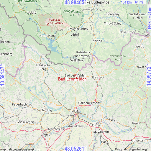
Bad Leonfelden GPS coordinates[2]
48° 31' 13.692" North, 14° 17' 40.524" East
| Map corner | latitude | longitude |
|---|---|---|
| Upper-left | 48.98405°, | 13.59147° |
| Center: | 48.52047°, | 14.29459° |
| Lower-right: | 48.05261°, | 14.99772° |
| Map W x H: | 103.6×103.6 km | = 64.4×64.4mi |
| max Lat: | 48.98333° ⇑5.2% North |
| Bad Leonfelden: | 48.52047° |
| min Lat: | ⇓94.8% South 46.48841° |
| min Long | Bad Leonfelden | max Long |
| 9.57802° | 14.29459° | 17.1° |
| W 42%⇐ | ⇒58% E |
Elevation
Elevation of Bad Leonfelden is 746 m = 2448 ft, and this is 240.5 m = 789 ft above average elevation for this country.
| Max E: |
2140 m = 7021 ft | 18.4% |
| Bad Leonfelden | 746 m 2448 ft | |
| Avg. | 505.5 m = 1658 ft | |
Min E: |
118 m = 387 ft | 81.6% |
See also: Austria elevation on elevation.city.
Geographical zone
Bad Leonfelden is located in North temperate zone (between Tropic of Cancer and the Arctic Circle). Distance of this North polar circle is 2006.2 km =1246.6 mi to North.| Distance of | km | miles | from Bad Leonfelden |
|---|---|---|---|
| North Pole | 4612.1 | 2865.8 | to North |
| Arctic Circle | 2006.2 | 1246.6 | to North |
| Tropic Cancer | 2789.1 | 1733.1 | to South |
| Equator | 5395 | 3352.3 | to South |


Nearby cities:
15 places around Bad Leonfelden: (largest is in red/bold)
• Ahorn
8.9 km =5.5 mi,  272°
272°
• Burgfried
0.1 km =0.1 mi,  127°
127°
• Haibach im Mühlkreis
9.2 km =5.7 mi,  156°
156°
• Hellmonsödt
9.7 km =6 mi,  177°
177°
• Kirchschlag bei Linz
12.2 km =7.6 mi,  186°
186°
• Oberneukirchen
8.2 km =5.1 mi,  220°
220°
• Ottenschlag im Mühlkreis
9 km =5.6 mi, 132°
• Reichenau im Mühlkreis
8.1 km =5 mi,  150°
150°
• Reichenthal
7.1 km =4.4 mi,  69°
69°
• Sankt Veit im Mühlkreis
11.3 km =7 mi,  238°
238°
• Schenkenfelden
5.3 km =3.3 mi,  111°
111°
• Sonnberg im Mühlkreis
6.8 km =4.2 mi,  169°
169°
• Summerau
11.3 km =7 mi, 72°
• Vorderweissenbach
6.6 km =4.1 mi,  301°
301°
• Zwettl an der Rodl
6.3 km =3.9 mi,  195°
195°
Sources, notices
• [Note1] Compared only with cities in Austria existing in our database
• [Src1] Map data: © OpenStreetMap contributors (CC-BY-SA)
• [Src2] Other city data from geonames.org with taken over terms of usage.
• [Src3] Geographical zone / Annual Mean Temperature by Robert A. Rohde @ Wikipedia
