Peisching geodata
Peisching (Lower Austria) is a populated place; located in Austria in Europe/Vienna (GMT+2) time zone. With population of 722 people, there are 1798 cities with bigger population in this country. Compared to other cities in Austria, 54.6% of cities are located further ↓South; 83.5% of cities are located further ←West and 65.5% of cities have higher elevation than Peisching. Note1
Administrative division(s):
- Level 1: Lower Austria
- Level 2: Politischer Bezirk Neunkirchen
- Level 3: Neunkirchen


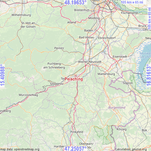
Peisching GPS coordinates[2]
47° 43' 32.52" North, 16° 6' 46.8" East
| Map corner | latitude | longitude |
|---|---|---|
| Upper-left | 48.19653°, | 15.40988° |
| Center: | 47.7257°, | 16.113° |
| Lower-right: | 47.25057°, | 16.81613° |
| Map W x H: | 105.2×105.2 km | = 65.4×65.4mi |
| max Lat: | 48.98333° ⇑45.4% North |
| Peisching: | 47.7257° |
| min Lat: | ⇓54.6% South 46.48841° |
| min Long | Peisching | max Long |
| 9.57802° | 16.113° | 17.1° |
| W 83.5%⇐ | ⇒16.5% E |
Elevation
Elevation of Peisching is 352 m = 1155 ft, and this is 153.5 m = 504 ft below average elevation for this country.
| Max E: |
2140 m = 7021 ft | 65.5% |
| Avg. | 505.5 m = 1658 ft | |
| Peisching | 352 m = 1155 ft | |
Min E: |
118 m = 387 ft | 34.5% |
See also: Austria elevation on elevation.city.
Geographical zone
Peisching is located in North temperate zone (between Tropic of Cancer and the Arctic Circle). Distance of this North polar circle is 2094.6 km =1301.5 mi to North.| Distance of | km | miles | from Peisching |
|---|---|---|---|
| North Pole | 4700.5 | 2920.8 | to North |
| Arctic Circle | 2094.6 | 1301.5 | to North |
| Tropic Cancer | 2700.7 | 1678.1 | to South |
| Equator | 5306.6 | 3297.4 | to South |


Nearby cities:
15 places around Peisching: (largest is in red/bold)
• Breitenau
2.4 km =1.5 mi,  68°
68°
• Loipersbach
1 km =0.6 mi,  164°
164°
• Mollram
4 km =2.5 mi,  335°
335°
• Natschbach
2 km =1.2 mi,  215°
215°
• Neunkirchen
2.4 km =1.5 mi,  257°
257°
• Pitten
5.4 km =3.4 mi,  100°
100°
• Raglitz
5.4 km =3.4 mi,  299°
299°
• Saubersdorf
7.1 km =4.4 mi,  3°
3°
• Scheiblingkirchen
7.3 km =4.5 mi,  167°
167°
• Schwarzau am Steinfeld
4.4 km =2.7 mi,  81°
81°
• Seebenstein
3.8 km =2.4 mi,  140°
140°
• Ternitz
5.9 km =3.7 mi, 259°
• Wartmannstetten
4.6 km =2.9 mi, 218°
• Wimpassing im Schwarzatale
6.5 km =4 mi,  247°
247°
• Würflach
7.1 km =4.4 mi,  322°
322°
Sources, notices
• [Note1] Compared only with cities in Austria existing in our database
• [Src1] Map data: © OpenStreetMap contributors (CC-BY-SA)
• [Src2] Other city data from geonames.org with taken over terms of usage.
• [Src3] Geographical zone / Annual Mean Temperature by Robert A. Rohde @ Wikipedia
