Breitenau geodata
Breitenau (Lower Austria) is a seat of a third-order administrative division; located in Austria in Europe/Vienna (GMT+2) time zone. With population of 1,576 people, there are 793 cities with bigger population in this country. Compared to other cities in Austria, 55% of cities are located further ↓South; 84.5% of cities are located further ←West and 67.7% of cities have higher elevation than Breitenau. Note1
Administrative division(s):
- Level 1: Lower Austria
- Level 2: Politischer Bezirk Neunkirchen
- Level 3: Breitenau


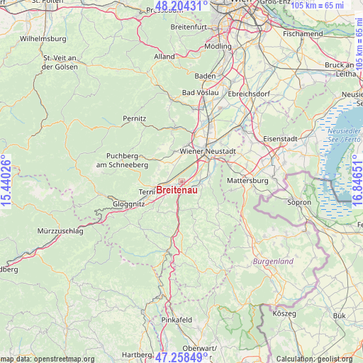
Breitenau GPS coordinates[2]
47° 44' 0.78" North, 16° 8' 36.168" East
| Map corner | latitude | longitude |
|---|---|---|
| Upper-left | 48.20431°, | 15.44026° |
| Center: | 47.73355°, | 16.14338° |
| Lower-right: | 47.25849°, | 16.84651° |
| Map W x H: | 105.2×105.2 km | = 65.4×65.4mi |
| max Lat: | 48.98333° ⇑45% North |
| Breitenau: | 47.73355° |
| min Lat: | ⇓55% South 46.48841° |
| min Long | Breitenau | max Long |
| 9.57802° | 16.14338° | 17.1° |
| W 84.5%⇐ | ⇒15.5% E |
Elevation
Elevation of Breitenau is 340 m = 1115 ft, and this is 165.5 m = 543 ft below average elevation for this country.
| Max E: |
2140 m = 7021 ft | 67.7% |
| Avg. | 505.5 m = 1658 ft | |
| Breitenau | 340 m = 1115 ft | |
Min E: |
118 m = 387 ft | 32.3% |
See also: Austria elevation on elevation.city.
Geographical zone
Breitenau is located in North temperate zone (between Tropic of Cancer and the Arctic Circle). Distance of this North polar circle is 2093.7 km =1301 mi to North.| Distance of | km | miles | from Breitenau |
|---|---|---|---|
| North Pole | 4699.6 | 2920.2 | to North |
| Arctic Circle | 2093.7 | 1301 | to North |
| Tropic Cancer | 2701.6 | 1678.7 | to South |
| Equator | 5307.5 | 3297.9 | to South |


Nearby cities:
15 places around Breitenau: (largest is in red/bold)
• Bad Erlach
5.4 km =3.4 mi,  97°
97°
• Haderswörth
8 km =5 mi,  90°
90°
• Lanzenkirchen
5.7 km =3.5 mi, 87°
• Loipersbach
2.7 km =1.7 mi,  226°
226°
• Mollram
4.8 km =3 mi,  305°
305°
• Natschbach
4.2 km =2.6 mi, 234°
• Neunkirchen
4.9 km =3 mi,  253°
253°
• Peisching
2.4 km =1.5 mi, 248°
• Pitten
3.5 km =2.2 mi,  122°
122°
• Raglitz
7.2 km =4.5 mi,  284°
284°
• Saubersdorf
6.5 km =4 mi,  343°
343°
• Schwarzau am Steinfeld
2.1 km =1.3 mi, 95°
• Seebenstein
3.8 km =2.4 mi,  178°
178°
• Walpersbach
7 km =4.3 mi,  105°
105°
• Wartmannstetten
6.8 km =4.2 mi, 228°
Sources, notices
• [Note1] Compared only with cities in Austria existing in our database
• [Src1] Map data: © OpenStreetMap contributors (CC-BY-SA)
• [Src2] Other city data from geonames.org with taken over terms of usage.
• [Src3] Geographical zone / Annual Mean Temperature by Robert A. Rohde @ Wikipedia
