Afiesl geodata
Afiesl (Upper Austria) is a seat of a third-order administrative division; located in Austria in Europe/Vienna (GMT+2) time zone. In our database, there are 2958 cities with bigger population. Compared to other cities in Austria, 96.2% of cities are located further ↓South; 62.1% of cities are located further →East and 87.9% of cities have lower elevation than Afiesl. Note1
Administrative division(s):
- Level 1: Upper Austria
- Level 2: Politischer Bezirk Rohrbach
- Level 3: Afiesl


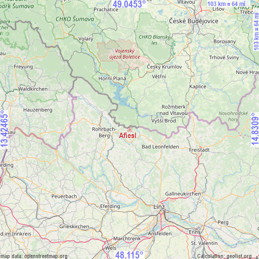
Afiesl GPS coordinates[2]
48° 34' 56.244" North, 14° 7' 39.972" East
| Map corner | latitude | longitude |
|---|---|---|
| Upper-left | 49.0453°, | 13.42465° |
| Center: | 48.58229°, | 14.12777° |
| Lower-right: | 48.115°, | 14.8309° |
| Map W x H: | 103.4×103.4 km | = 64.2×64.2mi |
| max Lat: | 48.98333° ⇑3.8% North |
| Afiesl: | 48.58229° |
| min Lat: | ⇓96.2% South 46.48841° |
| min Long | Afiesl | max Long |
| 9.57802° | 14.12777° | 17.1° |
| W 37.9%⇐ | ⇒62.1% E |
Elevation
Elevation of Afiesl is 843 m = 2766 ft, and this is 337.5 m = 1107 ft above average elevation for this country.
| Max E: |
2140 m = 7021 ft | 12.1% |
| Afiesl | 843 m 2766 ft | |
| Avg. | 505.5 m = 1658 ft | |
Min E: |
118 m = 387 ft | 87.9% |
See also: Austria elevation on elevation.city.
Geographical zone
Afiesl is located in North temperate zone (between Tropic of Cancer and the Arctic Circle). Distance of this North polar circle is 1999.3 km =1242.3 mi to North.| Distance of | km | miles | from Afiesl |
|---|---|---|---|
| North Pole | 4605.2 | 2861.5 | to North |
| Arctic Circle | 1999.3 | 1242.3 | to North |
| Tropic Cancer | 2795.9 | 1737.3 | to South |
| Equator | 5401.8 | 3356.5 | to South |


Nearby cities:
15 places around Afiesl: (largest is in red/bold)
• Ahorn
7.3 km =4.5 mi,  152°
152°
• Aigen im Mühlkreis
13.5 km =8.4 mi,  301°
301°
• Arnreit
11.7 km =7.3 mi,  236°
236°
• Bad Leonfelden
14.1 km =8.8 mi,  119°
119°
• Berg bei Rohrbach
10 km =6.2 mi,  267°
267°
• Burgfried
14.2 km =8.8 mi, 119°
• Haslach an der Mühl
6.5 km =4 mi,  263°
263°
• Neufelden
14.6 km =9.1 mi,  221°
221°
• Oberneukirchen
14.9 km =9.3 mi, 151°
• Oepping
13.6 km =8.5 mi,  279°
279°
• Rohrbach in Oberösterreich
10.3 km =6.4 mi, 264°
• Sankt Johann am Wimberg
10.5 km =6.5 mi,  178°
178°
• Sankt Peter am Wimberg
9.6 km =6 mi,  202°
202°
• Sankt Veit im Mühlkreis
13 km =8.1 mi,  168°
168°
• Vorderweissenbach
7.4 km =4.6 mi, 116°
Sources, notices
• [Note1] Compared only with cities in Austria existing in our database
• [Src1] Map data: © OpenStreetMap contributors (CC-BY-SA)
• [Src2] Other city data from geonames.org with taken over terms of usage.
• [Src3] Geographical zone / Annual Mean Temperature by Robert A. Rohde @ Wikipedia
