Rindbach geodata
Rindbach (Upper Austria) is a populated place; located in Austria in Europe/Vienna (GMT+2) time zone. With population of 555 people, there are 2298 cities with bigger population in this country. Compared to other cities in Austria, 57.4% of cities are located further ↓South; 69.2% of cities are located further →East and 53.6% of cities have higher elevation than Rindbach. Note1
Administrative division(s):
- Level 1: Upper Austria
- Level 2: Politischer Bezirk Gmunden
- Level 3: Ebensee


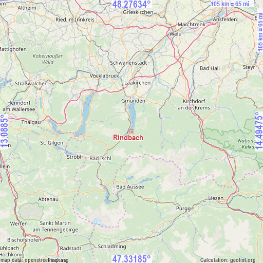
Rindbach GPS coordinates[2]
47° 48' 22.464" North, 13° 47' 29.832" East
| Map corner | latitude | longitude |
|---|---|---|
| Upper-left | 48.27634°, | 13.0885° |
| Center: | 47.80624°, | 13.79162° |
| Lower-right: | 47.33185°, | 14.49475° |
| Map W x H: | 105×105 km | = 65.2×65.2mi |
| max Lat: | 48.98333° ⇑42.6% North |
| Rindbach: | 47.80624° |
| min Lat: | ⇓57.4% South 46.48841° |
| min Long | Rindbach | max Long |
| 9.57802° | 13.79162° | 17.1° |
| W 30.8%⇐ | ⇒69.2% E |
Elevation
Elevation of Rindbach is 430 m = 1411 ft, and this is 75.5 m = 248 ft below average elevation for this country.
| Max E: |
2140 m = 7021 ft | 53.6% |
| Avg. | 505.5 m = 1658 ft | |
| Rindbach | 430 m = 1411 ft | |
Min E: |
118 m = 387 ft | 46.4% |
See also: Austria elevation on elevation.city.
Geographical zone
Rindbach is located in North temperate zone (between Tropic of Cancer and the Arctic Circle). Distance of this North polar circle is 2085.6 km =1295.9 mi to North.| Distance of | km | miles | from Rindbach |
|---|---|---|---|
| North Pole | 4691.5 | 2915.2 | to North |
| Arctic Circle | 2085.6 | 1295.9 | to North |
| Tropic Cancer | 2709.6 | 1683.7 | to South |
| Equator | 5315.6 | 3303 | to South |


Nearby cities:
15 places around Rindbach: (largest is in red/bold)
• Altmünster
10.9 km =6.8 mi,  349°
349°
• Ebensee
0.9 km =0.6 mi,  276°
276°
• Eck
12.5 km =7.8 mi, 353°
• Gmunden
12.5 km =7.8 mi,  2°
2°
• Grasberg
9.5 km =5.9 mi,  330°
330°
• Großkufhaus
13.4 km =8.3 mi,  342°
342°
• Grünau im Almtal
13.4 km =8.3 mi,  66°
66°
• Langwies
7.1 km =4.4 mi,  231°
231°
• Nachdemsee
7.5 km =4.7 mi, 344°
• Neukirchen
9.7 km =6 mi,  321°
321°
• Pinsdorf
13.8 km =8.6 mi, 353°
• Rettenbach
13 km =8.1 mi, 229°
• Roith
4 km =2.5 mi, 230°
• Sankt Konrad
13.9 km =8.6 mi,  31°
31°
• Traunkirchen
4.3 km =2.7 mi,  357°
357°
Sources, notices
• [Note1] Compared only with cities in Austria existing in our database
• [Src1] Map data: © OpenStreetMap contributors (CC-BY-SA)
• [Src2] Other city data from geonames.org with taken over terms of usage.
• [Src3] Geographical zone / Annual Mean Temperature by Robert A. Rohde @ Wikipedia
