Langwies geodata
Langwies (Upper Austria) is a populated place; located in Austria in Europe/Vienna (GMT+2) time zone. With population of 573 people, there are 2236 cities with bigger population in this country. Compared to other cities in Austria, 55.8% of cities are located further ↓South; 71.1% of cities are located further →East and 50.2% of cities have lower elevation than Langwies. Note1
Administrative division(s):
- Level 1: Upper Austria
- Level 2: Politischer Bezirk Gmunden
- Level 3: Ebensee


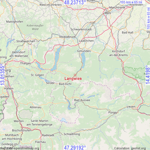
Langwies GPS coordinates[2]
47° 46' 0.012" North, 13° 43' 0.012" East
| Map corner | latitude | longitude |
|---|---|---|
| Upper-left | 48.23713°, | 13.01355° |
| Center: | 47.76667°, | 13.71667° |
| Lower-right: | 47.29192°, | 14.4198° |
| Map W x H: | 105.1×105.1 km | = 65.3×65.3mi |
| max Lat: | 48.98333° ⇑44.2% North |
| Langwies: | 47.76667° |
| min Lat: | ⇓55.8% South 46.48841° |
| min Long | Langwies | max Long |
| 9.57802° | 13.71667° | 17.1° |
| W 28.9%⇐ | ⇒71.1% E |
Elevation
Elevation of Langwies is 451 m = 1480 ft, and this is 54.5 m = 179 ft below average elevation for this country.
| Max E: |
2140 m = 7021 ft | 49.8% |
| Avg. | 505.5 m = 1658 ft | |
| Langwies | 451 m = 1480 ft | |
Min E: |
118 m = 387 ft | 50.2% |
See also: Austria elevation on elevation.city.
Geographical zone
Langwies is located in North temperate zone (between Tropic of Cancer and the Arctic Circle). Distance of this North polar circle is 2090 km =1298.7 mi to North.| Distance of | km | miles | from Langwies |
|---|---|---|---|
| North Pole | 4695.9 | 2917.9 | to North |
| Arctic Circle | 2090 | 1298.7 | to North |
| Tropic Cancer | 2705.2 | 1680.9 | to South |
| Equator | 5311.2 | 3300.2 | to South |


Nearby cities:
15 places around Langwies: (largest is in red/bold)
• Ahorn
10.4 km =6.5 mi,  234°
234°
• Bad Ischl
9.6 km =6 mi, 229°
• Ebensee
6.5 km =4 mi,  45°
45°
• Jainzen
9.3 km =5.8 mi, 233°
• Kaltenbach
10.5 km =6.5 mi, 230°
• Kreutern
10.7 km =6.6 mi,  241°
241°
• Nachdemsee
12.2 km =7.6 mi,  17°
17°
• Neukirchen
12.1 km =7.5 mi,  358°
358°
• Reiterndorf
9.6 km =6 mi,  223°
223°
• Rettenbach
5.9 km =3.7 mi, 227°
• Rindbach
7.1 km =4.4 mi, 51°
• Roith
3.1 km =1.9 mi, 53°
• Steinfeld
8.7 km =5.4 mi, 226°
• Sulzbach
10.7 km =6.6 mi, 222°
• Traunkirchen
10.2 km =6.3 mi,  32°
32°
Sources, notices
• [Note1] Compared only with cities in Austria existing in our database
• [Src1] Map data: © OpenStreetMap contributors (CC-BY-SA)
• [Src2] Other city data from geonames.org with taken over terms of usage.
• [Src3] Geographical zone / Annual Mean Temperature by Robert A. Rohde @ Wikipedia
