Nachdemsee geodata
Nachdemsee (Upper Austria) is a populated place; located in Austria in Europe/Vienna (GMT+2) time zone. With population of 541 people, there are 2356 cities with bigger population in this country. Compared to other cities in Austria, 59.8% of cities are located further ↓South; 70% of cities are located further →East and 56% of cities have lower elevation than Nachdemsee. Note1
Administrative division(s):
- Level 1: Upper Austria
- Level 2: Politischer Bezirk Gmunden
- Level 3: Altmünster


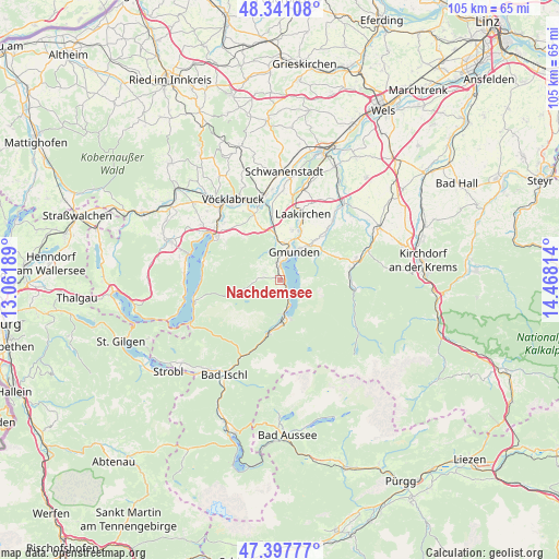
Nachdemsee GPS coordinates[2]
47° 52' 17.652" North, 13° 45' 54.036" East
| Map corner | latitude | longitude |
|---|---|---|
| Upper-left | 48.34108°, | 13.06189° |
| Center: | 47.87157°, | 13.76501° |
| Lower-right: | 47.39777°, | 14.46814° |
| Map W x H: | 104.9×104.9 km | = 65.2×65.2mi |
| max Lat: | 48.98333° ⇑40.2% North |
| Nachdemsee: | 47.87157° |
| min Lat: | ⇓59.8% South 46.48841° |
| min Long | Nachdemsee | max Long |
| 9.57802° | 13.76501° | 17.1° |
| W 30%⇐ | ⇒70% E |
Elevation
Elevation of Nachdemsee is 492 m = 1614 ft, and this is 13.5 m = 44 ft below average elevation for this country.
| Max E: |
2140 m = 7021 ft | 44% |
| Avg. | 505.5 m = 1658 ft | |
| Nachdemsee | 492 m = 1614 ft | |
Min E: |
118 m = 387 ft | 56% |
See also: Austria elevation on elevation.city.
Geographical zone
Nachdemsee is located in North temperate zone (between Tropic of Cancer and the Arctic Circle). Distance of this North polar circle is 2078.4 km =1291.5 mi to North.| Distance of | km | miles | from Nachdemsee |
|---|---|---|---|
| North Pole | 4684.2 | 2910.6 | to North |
| Arctic Circle | 2078.4 | 1291.5 | to North |
| Tropic Cancer | 2716.9 | 1688.2 | to South |
| Equator | 5322.8 | 3307.4 | to South |


Nearby cities:
15 places around Nachdemsee: (largest is in red/bold)
• Altmünster
3.4 km =2.1 mi,  358°
358°
• Ebensee
7.2 km =4.5 mi,  171°
171°
• Eck
5.2 km =3.2 mi,  6°
6°
• Gmunden
5.8 km =3.6 mi,  26°
26°
• Grasberg
2.8 km =1.7 mi,  291°
291°
• Großkufhaus
5.9 km =3.7 mi,  339°
339°
• Gschwandt
9.3 km =5.8 mi,  40°
40°
• Kleinreith
8 km =5 mi,  16°
16°
• Neukirchen
4 km =2.5 mi,  275°
275°
• Ohlsdorf
10.1 km =6.3 mi, 11°
• Pinsdorf
6.5 km =4 mi,  3°
3°
• Rindbach
7.5 km =4.7 mi,  164°
164°
• Roith
9.9 km =6.2 mi,  186°
186°
• Traunkirchen
3.5 km =2.2 mi,  148°
148°
• Wiesen
8.6 km =5.3 mi,  352°
352°
Sources, notices
• [Note1] Compared only with cities in Austria existing in our database
• [Src1] Map data: © OpenStreetMap contributors (CC-BY-SA)
• [Src2] Other city data from geonames.org with taken over terms of usage.
• [Src3] Geographical zone / Annual Mean Temperature by Robert A. Rohde @ Wikipedia
