Ravelsbach geodata
Ravelsbach (Lower Austria) is a seat of a third-order administrative division; located in Austria in Europe/Vienna (GMT+2) time zone. With population of 657 people, there are 1963 cities with bigger population in this country. Compared to other cities in Austria, 95.5% of cities are located further ↓South; 76% of cities are located further ←West and 78.7% of cities have higher elevation than Ravelsbach. Note1
Administrative division(s):
- Level 1: Lower Austria
- Level 2: Politischer Bezirk Hollabrunn
- Level 3: Ravelsbach


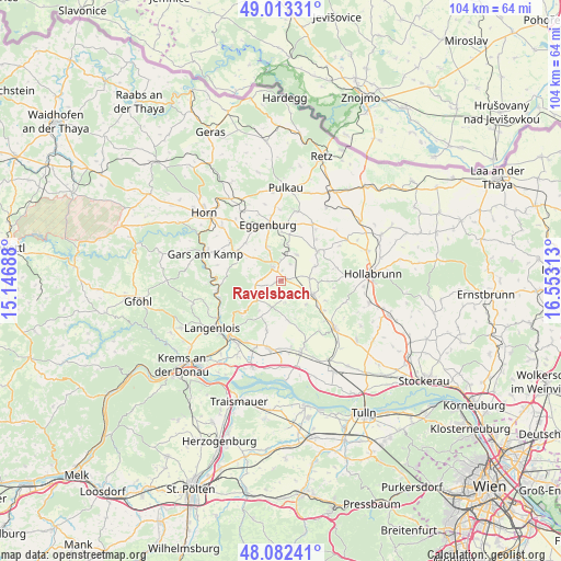
Ravelsbach GPS coordinates[2]
48° 33' 0" North, 15° 51' 0" East
| Map corner | latitude | longitude |
|---|---|---|
| Upper-left | 49.01331°, | 15.14688° |
| Center: | 48.55°, | 15.85° |
| Lower-right: | 48.08241°, | 16.55313° |
| Map W x H: | 103.5×103.5 km | = 64.3×64.3mi |
| max Lat: | 48.98333° ⇑4.5% North |
| Ravelsbach: | 48.55° |
| min Lat: | ⇓95.5% South 46.48841° |
| min Long | Ravelsbach | max Long |
| 9.57802° | 15.85° | 17.1° |
| W 76%⇐ | ⇒24% E |
Elevation
Elevation of Ravelsbach is 280 m = 919 ft, and this is 225.5 m = 740 ft below average elevation for this country.
| Max E: |
2140 m = 7021 ft | 78.7% |
| Avg. | 505.5 m = 1658 ft | |
| Ravelsbach | 280 m = 919 ft | |
Min E: |
118 m = 387 ft | 21.3% |
See also: Austria elevation on elevation.city.
Geographical zone
Ravelsbach is located in North temperate zone (between Tropic of Cancer and the Arctic Circle). Distance of this North polar circle is 2002.9 km =1244.5 mi to North.| Distance of | km | miles | from Ravelsbach |
|---|---|---|---|
| North Pole | 4608.8 | 2863.8 | to North |
| Arctic Circle | 2002.9 | 1244.5 | to North |
| Tropic Cancer | 2792.3 | 1735.1 | to South |
| Equator | 5398.3 | 3354.3 | to South |


Nearby cities:
15 places around Ravelsbach: (largest is in red/bold)
• Eggenburg
10.1 km =6.3 mi,  347°
347°
• Engabrunn
13.3 km =8.3 mi,  213°
213°
• Fels am Wagram
13.2 km =8.2 mi,  190°
190°
• Feuersbrunn
13.9 km =8.6 mi,  200°
200°
• Großriedenthal
7.5 km =4.7 mi,  170°
170°
• Großweikersdorf
13.1 km =8.1 mi,  131°
131°
• Kirchberg am Wagram
13.6 km =8.5 mi, 165°
• Maissau
2.9 km =1.8 mi,  330°
330°
• Röschitz
10.6 km =6.6 mi, 347°
• Schönberg
11.6 km =7.2 mi,  251°
251°
• Sitzendorf an der Schmida
8.7 km =5.4 mi,  51°
51°
• Sonnberg
14.8 km =9.2 mi,  97°
97°
• Strass
12.6 km =7.8 mi,  222°
222°
• Ziersdorf
6.1 km =3.8 mi,  111°
111°
• Zöbing
14.3 km =8.9 mi,  238°
238°
Sources, notices
• [Note1] Compared only with cities in Austria existing in our database
• [Src1] Map data: © OpenStreetMap contributors (CC-BY-SA)
• [Src2] Other city data from geonames.org with taken over terms of usage.
• [Src3] Geographical zone / Annual Mean Temperature by Robert A. Rohde @ Wikipedia
