Maissau geodata
Maissau (Lower Austria) is a seat of a third-order administrative division; located in Austria in Europe/Vienna (GMT+2) time zone. With population of 915 people, there are 1404 cities with bigger population in this country. Compared to other cities in Austria, 96% of cities are located further ↓South; 75.6% of cities are located further ←West and 68.6% of cities have higher elevation than Maissau. Note1
Administrative division(s):
- Level 1: Lower Austria
- Level 2: Politischer Bezirk Hollabrunn
- Level 3: Maissau


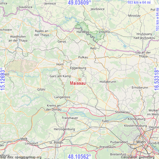
Maissau GPS coordinates[2]
48° 34' 22.8" North, 15° 49' 48.18" East
| Map corner | latitude | longitude |
|---|---|---|
| Upper-left | 49.03609°, | 15.12693° |
| Center: | 48.573°, | 15.83005° |
| Lower-right: | 48.10562°, | 16.53318° |
| Map W x H: | 103.5×103.5 km | = 64.3×64.3mi |
| max Lat: | 48.98333° ⇑4% North |
| Maissau: | 48.573° |
| min Lat: | ⇓96% South 46.48841° |
| min Long | Maissau | max Long |
| 9.57802° | 15.83005° | 17.1° |
| W 75.6%⇐ | ⇒24.4% E |
Elevation
Elevation of Maissau is 336 m = 1102 ft, and this is 169.5 m = 556 ft below average elevation for this country.
| Max E: |
2140 m = 7021 ft | 68.6% |
| Avg. | 505.5 m = 1658 ft | |
| Maissau | 336 m = 1102 ft | |
Min E: |
118 m = 387 ft | 31.4% |
See also: Austria elevation on elevation.city.
Geographical zone
Maissau is located in North temperate zone (between Tropic of Cancer and the Arctic Circle). Distance of this North polar circle is 2000.4 km =1243 mi to North.| Distance of | km | miles | from Maissau |
|---|---|---|---|
| North Pole | 4606.3 | 2862.2 | to North |
| Arctic Circle | 2000.4 | 1243 | to North |
| Tropic Cancer | 2794.9 | 1736.7 | to South |
| Equator | 5400.8 | 3355.9 | to South |


Nearby cities:
15 places around Maissau: (largest is in red/bold)
• Eggenburg
7.4 km =4.6 mi,  353°
353°
• Engabrunn
14.9 km =9.3 mi,  203°
203°
• Fels am Wagram
15.6 km =9.7 mi,  183°
183°
• Gars am Kamp
13.1 km =8.1 mi,  277°
277°
• Großriedenthal
10.3 km =6.4 mi,  164°
164°
• Pulkau
14.8 km =9.2 mi,  8°
8°
• Ravelsbach
2.9 km =1.8 mi,  150°
150°
• Röschitz
7.8 km =4.8 mi, 353°
• Schrattenthal
15 km =9.3 mi,  20°
20°
• Schönberg
11.4 km =7.1 mi,  236°
236°
• Sigmundsherberg
13.6 km =8.5 mi,  334°
334°
• Sitzendorf an der Schmida
8.7 km =5.4 mi,  71°
71°
• Strass
13.8 km =8.6 mi,  211°
211°
• Ziersdorf
8.6 km =5.3 mi,  123°
123°
• Zöbing
14.7 km =9.1 mi,  227°
227°
Sources, notices
• [Note1] Compared only with cities in Austria existing in our database
• [Src1] Map data: © OpenStreetMap contributors (CC-BY-SA)
• [Src2] Other city data from geonames.org with taken over terms of usage.
• [Src3] Geographical zone / Annual Mean Temperature by Robert A. Rohde @ Wikipedia
