Großriedenthal geodata
Großriedenthal (Lower Austria) is a seat of a third-order administrative division; located in Austria in Europe/Vienna (GMT+2) time zone. With population of 423 people, there are 2595 cities with bigger population in this country. Compared to other cities in Austria, 93.9% of cities are located further ↓South; 76.5% of cities are located further ←West and 79.7% of cities have higher elevation than Großriedenthal. Note1
Administrative division(s):
- Level 1: Lower Austria
- Level 2: Politischer Bezirk Tulln
- Level 3: Großriedenthal


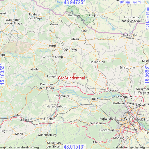
Großriedenthal GPS coordinates[2]
48° 28' 59.988" North, 15° 52' 0.012" East
| Map corner | latitude | longitude |
|---|---|---|
| Upper-left | 48.94725°, | 15.16355° |
| Center: | 48.48333°, | 15.86667° |
| Lower-right: | 48.01513°, | 16.5698° |
| Map W x H: | 103.6×103.6 km | = 64.4×64.4mi |
| max Lat: | 48.98333° ⇑6.1% North |
| Großriedenthal: | 48.48333° |
| min Lat: | ⇓93.9% South 46.48841° |
| min Long | Großriedenthal | max Long |
| 9.57802° | 15.86667° | 17.1° |
| W 76.5%⇐ | ⇒23.5% E |
Elevation
Elevation of Großriedenthal is 276 m = 906 ft, and this is 229.5 m = 753 ft below average elevation for this country.
| Max E: |
2140 m = 7021 ft | 79.7% |
| Avg. | 505.5 m = 1658 ft | |
| Großriedenthal | 276 m = 906 ft | |
Min E: |
118 m = 387 ft | 20.3% |
See also: Austria elevation on elevation.city.
Geographical zone
Großriedenthal is located in North temperate zone (between Tropic of Cancer and the Arctic Circle). Distance of this North polar circle is 2010.3 km =1249.1 mi to North.| Distance of | km | miles | from Großriedenthal |
|---|---|---|---|
| North Pole | 4616.2 | 2868.4 | to North |
| Arctic Circle | 2010.3 | 1249.1 | to North |
| Tropic Cancer | 2784.9 | 1730.5 | to South |
| Equator | 5390.8 | 3349.7 | to South |


Nearby cities:
15 places around Großriedenthal: (largest is in red/bold)
• Absdorf
12.4 km =7.7 mi,  138°
138°
• Engabrunn
9.4 km =5.8 mi,  246°
246°
• Etsdorf am Kamp
11.3 km =7 mi,  240°
240°
• Fels am Wagram
6.7 km =4.2 mi,  213°
213°
• Feuersbrunn
8.3 km =5.2 mi,  227°
227°
• Gobelsburg
12.5 km =7.8 mi,  258°
258°
• Grafenegg
10.5 km =6.5 mi, 235°
• Grafenwörth
10.6 km =6.6 mi,  217°
217°
• Großweikersdorf
8.6 km =5.3 mi,  98°
98°
• Hadersdorf am Kamp
11.7 km =7.3 mi, 251°
• Kirchberg am Wagram
6.1 km =3.8 mi,  158°
158°
• Maissau
10.3 km =6.4 mi,  344°
344°
• Ravelsbach
7.5 km =4.7 mi,  350°
350°
• Strass
10 km =6.2 mi, 259°
• Ziersdorf
6.9 km =4.3 mi,  40°
40°
Sources, notices
• [Note1] Compared only with cities in Austria existing in our database
• [Src1] Map data: © OpenStreetMap contributors (CC-BY-SA)
• [Src2] Other city data from geonames.org with taken over terms of usage.
• [Src3] Geographical zone / Annual Mean Temperature by Robert A. Rohde @ Wikipedia
