Prambachkirchen geodata
Prambachkirchen (Upper Austria) is a seat of a third-order administrative division; located in Austria in Europe/Vienna (GMT+2) time zone. With population of 1,164 people, there are 1087 cities with bigger population in this country. Compared to other cities in Austria, 86.7% of cities are located further ↓South; 66.7% of cities are located further →East and 61.4% of cities have higher elevation than Prambachkirchen. Note1
Administrative division(s):
- Level 1: Upper Austria
- Level 2: Politischer Bezirk Eferding
- Level 3: Prambachkirchen


Prambachkirchen GPS coordinates[2]
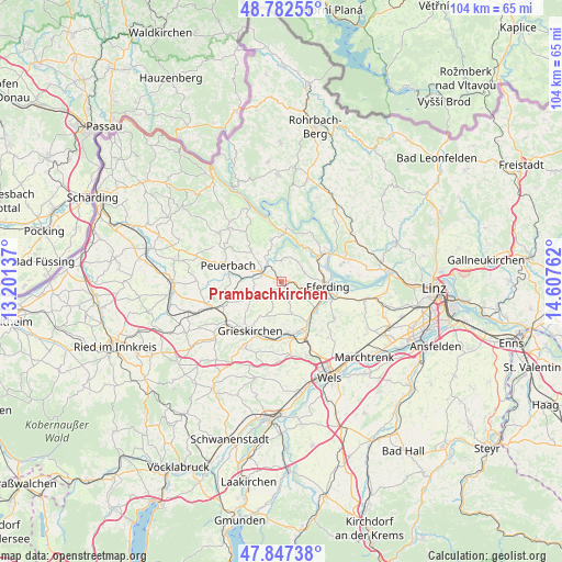
48° 19' 1.596" North, 13° 54' 16.164" East
| Map corner | latitude | longitude |
|---|---|---|
| Upper-left | 48.78255°, | 13.20137° |
| Center: | 48.31711°, | 13.90449° |
| Lower-right: | 47.84738°, | 14.60762° |
| Map W x H: | 104×104 km | = 64.6×64.6mi |
| max Lat: | 48.98333° ⇑13.3% North |
| Prambachkirchen: | 48.31711° |
| min Lat: | ⇓86.7% South 46.48841° |
| min Long | Prambachkirchen | max Long |
| 9.57802° | 13.90449° | 17.1° |
| W 33.3%⇐ | ⇒66.7% E |
Elevation
Elevation of Prambachkirchen is 374 m = 1227 ft, and this is 131.5 m = 431 ft below average elevation for this country.
| Max E: |
2140 m = 7021 ft | 61.4% |
| Avg. | 505.5 m = 1658 ft | |
| Prambachkirchen | 374 m = 1227 ft | |
Min E: |
118 m = 387 ft | 38.6% |
See also: Austria elevation on elevation.city.
Geographical zone
Prambachkirchen is located in North temperate zone (between Tropic of Cancer and the Arctic Circle). Distance of this North polar circle is 2028.8 km =1260.6 mi to North.| Distance of | km | miles | from Prambachkirchen |
|---|---|---|---|
| North Pole | 4634.7 | 2879.9 | to North |
| Arctic Circle | 2028.8 | 1260.6 | to North |
| Tropic Cancer | 2766.4 | 1719 | to South |
| Equator | 5372.4 | 3338.3 | to South |


Nearby cities:
15 places around Prambachkirchen: (largest is in red/bold)
• Aschach an der Donau
10.1 km =6.3 mi,  58°
58°
• Bad Schallerbach
9.7 km =6 mi,  173°
173°
• Eferding
8.8 km =5.5 mi,  96°
96°
• Fraham
10 km =6.2 mi,  111°
111°
• Grieskirchen
10.7 km =6.6 mi,  209°
209°
• Hartkirchen
9 km =5.6 mi, 55°
• Michaelnbach
6.3 km =3.9 mi,  238°
238°
• Peuerbach
10.3 km =6.4 mi,  287°
287°
• Pötting
10.6 km =6.6 mi,  249°
249°
• Sankt Agatha
8 km =5 mi,  345°
345°
• Sankt Marienkirchen an der Polsenz
6.1 km =3.8 mi,  160°
160°
• Schlüsslberg
11.2 km =7 mi,  192°
192°
• Unterfreundorf
6.9 km =4.3 mi, 156°
• Waizenkirchen
3.8 km =2.4 mi, 292°
• Wallern an der Trattnach
9.9 km =6.2 mi, 161°
Sources, notices
• [Note1] Compared only with cities in Austria existing in our database
• [Src1] Map data: © OpenStreetMap contributors (CC-BY-SA)
• [Src2] Other city data from geonames.org with taken over terms of usage.
• [Src3] Geographical zone / Annual Mean Temperature by Robert A. Rohde @ Wikipedia
