Peuerbach geodata
Peuerbach (Upper Austria) is a seat of a third-order administrative division; located in Austria in Europe/Vienna (GMT+2) time zone. With population of 1,475 people, there are 853 cities with bigger population in this country. Compared to other cities in Austria, 88.2% of cities are located further ↓South; 69.8% of cities are located further →East and 58.5% of cities have higher elevation than Peuerbach. Note1
Administrative division(s):
- Level 1: Upper Austria
- Level 2: Politischer Bezirk Grieskirchen
- Level 3: Peuerbach


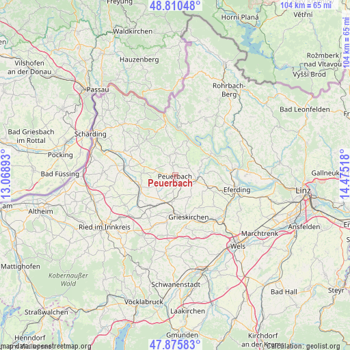
Peuerbach GPS coordinates[2]
48° 20' 43.08" North, 13° 46' 19.38" East
| Map corner | latitude | longitude |
|---|---|---|
| Upper-left | 48.81048°, | 13.06893° |
| Center: | 48.3453°, | 13.77205° |
| Lower-right: | 47.87583°, | 14.47518° |
| Map W x H: | 103.9×103.9 km | = 64.6×64.6mi |
| max Lat: | 48.98333° ⇑11.8% North |
| Peuerbach: | 48.3453° |
| min Lat: | ⇓88.2% South 46.48841° |
| min Long | Peuerbach | max Long |
| 9.57802° | 13.77205° | 17.1° |
| W 30.2%⇐ | ⇒69.8% E |
Elevation
Elevation of Peuerbach is 394 m = 1293 ft, and this is 111.5 m = 366 ft below average elevation for this country.
| Max E: |
2140 m = 7021 ft | 58.5% |
| Avg. | 505.5 m = 1658 ft | |
| Peuerbach | 394 m = 1293 ft | |
Min E: |
118 m = 387 ft | 41.5% |
See also: Austria elevation on elevation.city.
Geographical zone
Peuerbach is located in North temperate zone (between Tropic of Cancer and the Arctic Circle). Distance of this North polar circle is 2025.7 km =1258.7 mi to North.| Distance of | km | miles | from Peuerbach |
|---|---|---|---|
| North Pole | 4631.6 | 2877.9 | to North |
| Arctic Circle | 2025.7 | 1258.7 | to North |
| Tropic Cancer | 2769.6 | 1720.9 | to South |
| Equator | 5375.5 | 3340.2 | to South |


Nearby cities:
15 places around Peuerbach: (largest is in red/bold)
• Enzenkirchen
10.3 km =6.4 mi,  297°
297°
• Kallham
8.1 km =5 mi,  213°
213°
• Michaelnbach
7.7 km =4.8 mi,  145°
145°
• Natternbach
6 km =3.7 mi,  344°
344°
• Neukirchen am Walde
6.8 km =4.2 mi,  5°
5°
• Neumarkt im Hausruckkreis
8.7 km =5.4 mi,  201°
201°
• Prambachkirchen
10.3 km =6.4 mi,  107°
107°
• Pötting
6.9 km =4.3 mi,  180°
180°
• Raab
9.3 km =5.8 mi,  274°
274°
• Sankt Agatha
9.1 km =5.7 mi,  59°
59°
• Taufkirchen an der Trattnach
11 km =6.8 mi,  189°
189°
• Tolleterau
12.5 km =7.8 mi, 176°
• Waizenkirchen
6.5 km =4 mi,  104°
104°
• Waldkirchen am Wesen
11.2 km =7 mi,  19°
19°
• Zell an der Pram
11 km =6.8 mi,  252°
252°
Sources, notices
• [Note1] Compared only with cities in Austria existing in our database
• [Src1] Map data: © OpenStreetMap contributors (CC-BY-SA)
• [Src2] Other city data from geonames.org with taken over terms of usage.
• [Src3] Geographical zone / Annual Mean Temperature by Robert A. Rohde @ Wikipedia
