Untergreith geodata
Untergreith (Styria) is a populated place; located in Austria in Europe/Vienna (GMT+2) time zone. With population of 503 people, there are 2499 cities with bigger population in this country. Compared to other cities in Austria, 94.8% of cities are located further ↑North; 61.6% of cities are located further ←West and 62.9% of cities have higher elevation than Untergreith. Note1
Administrative division(s):
- Level 1: Styria
- Level 2: Politischer Bezirk Leibnitz
- Level 3: Sankt Johann im Saggautal


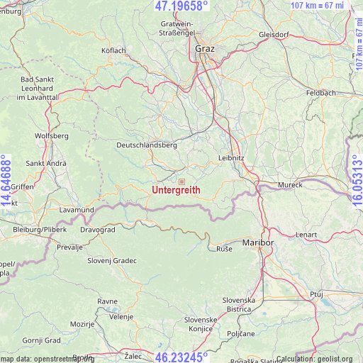
Untergreith GPS coordinates[2]
46° 43' 0.012" North, 15° 21' 0" East
| Map corner | latitude | longitude |
|---|---|---|
| Upper-left | 47.19658°, | 14.64688° |
| Center: | 46.71667°, | 15.35° |
| Lower-right: | 46.23245°, | 16.05313° |
| Map W x H: | 107.2×107.2 km | = 66.6×66.6mi |
| max Lat: | 48.98333° ⇑94.8% North |
| Untergreith: | 46.71667° |
| min Lat: | ⇓5.2% South 46.48841° |
| min Long | Untergreith | max Long |
| 9.57802° | 15.35° | 17.1° |
| W 61.6%⇐ | ⇒38.4% E |
Elevation
Elevation of Untergreith is 365 m = 1198 ft, and this is 140.5 m = 461 ft below average elevation for this country.
| Max E: |
2140 m = 7021 ft | 62.9% |
| Avg. | 505.5 m = 1658 ft | |
| Untergreith | 365 m = 1198 ft | |
Min E: |
118 m = 387 ft | 37.1% |
See also: Austria elevation on elevation.city.
Geographical zone
Untergreith is located in North temperate zone (between Tropic of Cancer and the Arctic Circle). Distance of this North polar circle is 2206.8 km =1371.2 mi to North.| Distance of | km | miles | from Untergreith |
|---|---|---|---|
| North Pole | 4812.7 | 2990.5 | to North |
| Arctic Circle | 2206.8 | 1371.2 | to North |
| Tropic Cancer | 2588.5 | 1608.4 | to South |
| Equator | 5194.4 | 3227.6 | to South |


Nearby cities:
15 places around Untergreith: (largest is in red/bold)
• Altenmarkt bei Wies
7.6 km =4.7 mi,  270°
270°
• Arnfels
6 km =3.7 mi,  137°
137°
• Brunn
4.1 km =2.5 mi,  290°
290°
• Eibiswald
8.5 km =5.3 mi,  246°
246°
• Eichberg-Trautenburg
8.3 km =5.2 mi,  108°
108°
• Gleinstätten
4.4 km =2.7 mi,  20°
20°
• Großklein
7.5 km =4.7 mi,  73°
73°
• Hörmsdorf
7.1 km =4.4 mi, 248°
• Oberhaag
3.6 km =2.2 mi,  202°
202°
• Pistorf
5.7 km =3.5 mi,  12°
12°
• Pitschgau
6.6 km =4.1 mi, 253°
• Sankt Johann im Saggautal
4.3 km =2.7 mi, 109°
• Sankt Martin im Sulmtal
6 km =3.7 mi,  317°
317°
• Sankt Peter im Sulmtal
8.5 km =5.3 mi,  295°
295°
• Wies
6 km =3.7 mi, 273°
Sources, notices
• [Note1] Compared only with cities in Austria existing in our database
• [Src1] Map data: © OpenStreetMap contributors (CC-BY-SA)
• [Src2] Other city data from geonames.org with taken over terms of usage.
• [Src3] Geographical zone / Annual Mean Temperature by Robert A. Rohde @ Wikipedia
