Seebenstein geodata
Seebenstein (Lower Austria) is a seat of a third-order administrative division; located in Austria in Europe/Vienna (GMT+2) time zone. With population of 924 people, there are 1391 cities with bigger population in this country. Compared to other cities in Austria, 53.3% of cities are located further ↓South; 84.6% of cities are located further ←West and 66.4% of cities have higher elevation than Seebenstein. Note1
Administrative division(s):
- Level 1: Lower Austria
- Level 2: Politischer Bezirk Neunkirchen
- Level 3: Seebenstein


Seebenstein GPS coordinates[2]
47° 41' 57.696" North, 16° 8' 41.424" East
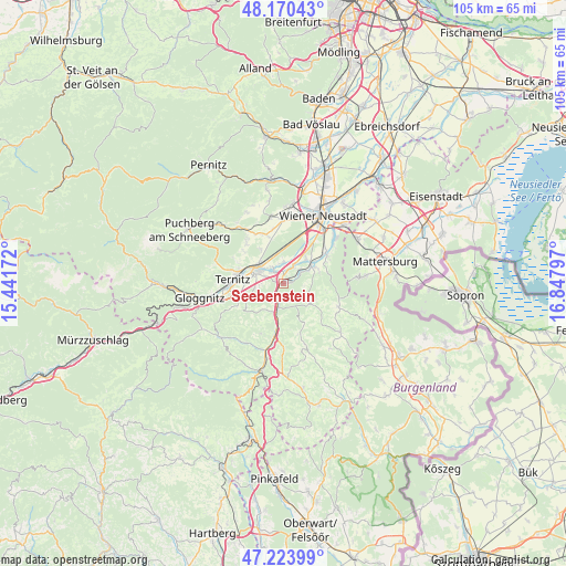
| Map corner | latitude | longitude |
|---|---|---|
| Upper-left | 48.17043°, | 15.44172° |
| Center: | 47.69936°, | 16.14484° |
| Lower-right: | 47.22399°, | 16.84797° |
| Map W x H: | 105.2×105.2 km | = 65.4×65.4mi |
| max Lat: | 48.98333° ⇑46.7% North |
| Seebenstein: | 47.69936° |
| min Lat: | ⇓53.3% South 46.48841° |
| min Long | Seebenstein | max Long |
| 9.57802° | 16.14484° | 17.1° |
| W 84.6%⇐ | ⇒15.4% E |
Elevation
Elevation of Seebenstein is 345 m = 1132 ft, and this is 160.5 m = 527 ft below average elevation for this country.
| Max E: |
2140 m = 7021 ft | 66.4% |
| Avg. | 505.5 m = 1658 ft | |
| Seebenstein | 345 m = 1132 ft | |
Min E: |
118 m = 387 ft | 33.6% |
See also: Austria elevation on elevation.city.
Geographical zone
Seebenstein is located in North temperate zone (between Tropic of Cancer and the Arctic Circle). Distance of this North polar circle is 2097.5 km =1303.3 mi to North.| Distance of | km | miles | from Seebenstein |
|---|---|---|---|
| North Pole | 4703.4 | 2922.6 | to North |
| Arctic Circle | 2097.5 | 1303.3 | to North |
| Tropic Cancer | 2697.8 | 1676.3 | to South |
| Equator | 5303.7 | 3295.6 | to South |


Nearby cities:
15 places around Seebenstein: (largest is in red/bold)
• Bad Erlach
6.1 km =3.8 mi,  59°
59°
• Breitenau
3.8 km =2.4 mi,  358°
358°
• Bromberg
6.2 km =3.9 mi,  127°
127°
• Lanzenkirchen
6.9 km =4.3 mi,  53°
53°
• Loipersbach
2.9 km =1.8 mi,  312°
312°
• Natschbach
3.8 km =2.4 mi,  290°
290°
• Neunkirchen
5.3 km =3.3 mi,  296°
296°
• Peisching
3.8 km =2.4 mi,  320°
320°
• Pitten
3.5 km =2.2 mi, 56°
• Scheiblingkirchen
4.3 km =2.7 mi,  190°
190°
• Schwarzau am Steinfeld
4.1 km =2.5 mi,  28°
28°
• Thernberg
6.2 km =3.9 mi,  152°
152°
• Walpersbach
6.9 km =4.3 mi,  73°
73°
• Warth
5.9 km =3.7 mi,  201°
201°
• Wartmannstetten
5.3 km =3.3 mi,  262°
262°
Sources, notices
• [Note1] Compared only with cities in Austria existing in our database
• [Src1] Map data: © OpenStreetMap contributors (CC-BY-SA)
• [Src2] Other city data from geonames.org with taken over terms of usage.
• [Src3] Geographical zone / Annual Mean Temperature by Robert A. Rohde @ Wikipedia
