Pattigham geodata
Pattigham (Upper Austria) is a seat of a third-order administrative division; located in Austria in Europe/Vienna (GMT+2) time zone. With population of 427 people, there are 2590 cities with bigger population in this country. Compared to other cities in Austria, 76.1% of cities are located further ↓South; 75.1% of cities are located further →East and 58.7% of cities have lower elevation than Pattigham. Note1
Administrative division(s):
- Level 1: Upper Austria
- Level 2: Politischer Bezirk Ried im Innkreis
- Level 3: Pattigham


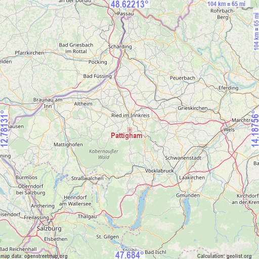
Pattigham GPS coordinates[2]
48° 9' 18.756" North, 13° 29' 3.948" East
| Map corner | latitude | longitude |
|---|---|---|
| Upper-left | 48.62213°, | 12.78131° |
| Center: | 48.15521°, | 13.48443° |
| Lower-right: | 47.684°, | 14.18756° |
| Map W x H: | 104.3×104.3 km | = 64.8×64.8mi |
| max Lat: | 48.98333° ⇑23.9% North |
| Pattigham: | 48.15521° |
| min Lat: | ⇓76.1% South 46.48841° |
| min Long | Pattigham | max Long |
| 9.57802° | 13.48443° | 17.1° |
| W 24.9%⇐ | ⇒75.1% E |
Elevation
Elevation of Pattigham is 509 m = 1670 ft, and this is 3.5 m = 11 ft above average elevation for this country.
| Max E: |
2140 m = 7021 ft | 41.3% |
| Pattigham | 509 m 1670 ft | |
| Avg. | 505.5 m = 1658 ft | |
Min E: |
118 m = 387 ft | 58.7% |
See also: Austria elevation on elevation.city.
Geographical zone
Pattigham is located in North temperate zone (between Tropic of Cancer and the Arctic Circle). Distance of this North polar circle is 2046.8 km =1271.8 mi to North.| Distance of | km | miles | from Pattigham |
|---|---|---|---|
| North Pole | 4652.7 | 2891.1 | to North |
| Arctic Circle | 2046.8 | 1271.8 | to North |
| Tropic Cancer | 2748.4 | 1707.8 | to South |
| Equator | 5354.4 | 3327.1 | to South |


Nearby cities:
15 places around Pattigham: (largest is in red/bold)
• Ampflwang
10.1 km =6.3 mi,  142°
142°
• Eberschwang
5.7 km =3.5 mi,  90°
90°
• Frankenburg
9.7 km =6 mi,  177°
177°
• Lohnsburg
6 km =3.7 mi,  257°
257°
• Maierhof
6.2 km =3.9 mi, 89°
• Maierhof
9.9 km =6.2 mi,  351°
351°
• Mehrnbach
6.9 km =4.3 mi,  328°
328°
• Neuhofen im Innkreis
4 km =2.5 mi, 347°
• Pramet
1.4 km =0.9 mi,  170°
170°
• Redleiten
8.3 km =5.2 mi,  187°
187°
• Ried im Innkreis
6.2 km =3.9 mi,  2°
2°
• Schildorn
1.9 km =1.2 mi,  236°
236°
• Siedlung
9.8 km =6.1 mi, 144°
• Tumeltsham
8.6 km =5.3 mi,  6°
6°
• Waldzell
4.8 km =3 mi, 242°
Sources, notices
• [Note1] Compared only with cities in Austria existing in our database
• [Src1] Map data: © OpenStreetMap contributors (CC-BY-SA)
• [Src2] Other city data from geonames.org with taken over terms of usage.
• [Src3] Geographical zone / Annual Mean Temperature by Robert A. Rohde @ Wikipedia
