Mehrnbach geodata
Mehrnbach (Upper Austria) is a populated place; located in Austria in Europe/Vienna (GMT+2) time zone. With population of 1,002 people, there are 1291 cities with bigger population in this country. Compared to other cities in Austria, 79.8% of cities are located further ↓South; 76% of cities are located further →East and 51.1% of cities have higher elevation than Mehrnbach. Note1
Administrative division(s):
- Level 1: Upper Austria
- Level 2: Politischer Bezirk Ried im Innkreis
- Level 3: Mehrnbach


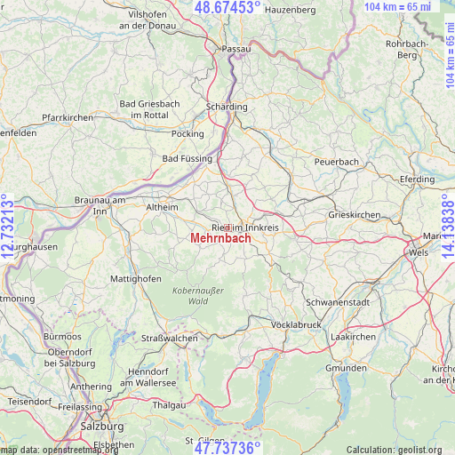
Mehrnbach GPS coordinates[2]
48° 12' 29.124" North, 13° 26' 6.9" East
| Map corner | latitude | longitude |
|---|---|---|
| Upper-left | 48.67453°, | 12.73213° |
| Center: | 48.20809°, | 13.43525° |
| Lower-right: | 47.73736°, | 14.13838° |
| Map W x H: | 104.2×104.2 km | = 64.7×64.7mi |
| max Lat: | 48.98333° ⇑20.2% North |
| Mehrnbach: | 48.20809° |
| min Lat: | ⇓79.8% South 46.48841° |
| min Long | Mehrnbach | max Long |
| 9.57802° | 13.43525° | 17.1° |
| W 24%⇐ | ⇒76% E |
Elevation
Elevation of Mehrnbach is 445 m = 1460 ft, and this is 60.5 m = 198 ft below average elevation for this country.
| Max E: |
2140 m = 7021 ft | 51.1% |
| Avg. | 505.5 m = 1658 ft | |
| Mehrnbach | 445 m = 1460 ft | |
Min E: |
118 m = 387 ft | 48.9% |
See also: Austria elevation on elevation.city.
Geographical zone
Mehrnbach is located in North temperate zone (between Tropic of Cancer and the Arctic Circle). Distance of this North polar circle is 2040.9 km =1268.2 mi to North.| Distance of | km | miles | from Mehrnbach |
|---|---|---|---|
| North Pole | 4646.8 | 2887.4 | to North |
| Arctic Circle | 2040.9 | 1268.2 | to North |
| Tropic Cancer | 2754.3 | 1711.4 | to South |
| Equator | 5360.2 | 3330.7 | to South |


Nearby cities:
15 places around Mehrnbach: (largest is in red/bold)
• Aurolzmünster
4.7 km =2.9 mi,  18°
18°
• Forchtenau
6.4 km =4 mi,  11°
11°
• Gurten
7.7 km =4.8 mi,  298°
298°
• Lohnsburg
7.5 km =4.7 mi,  197°
197°
• Maierhof
4.4 km =2.7 mi,  29°
29°
• Neuhofen im Innkreis
3.4 km =2.1 mi,  125°
125°
• Pattigham
6.9 km =4.3 mi,  148°
148°
• Pramet
8.2 km =5.1 mi, 151°
• Ried im Innkreis
4 km =2.5 mi,  84°
84°
• Schildorn
7.2 km =4.5 mi,  163°
163°
• Tumeltsham
5.3 km =3.3 mi,  60°
60°
• Utzenaich
7.8 km =4.8 mi, 14°
• Waldzell
8.1 km =5 mi,  184°
184°
• Wildenau
8.7 km =5.4 mi,  268°
268°
• Wippenham
4.5 km =2.8 mi,  291°
291°
Sources, notices
• [Note1] Compared only with cities in Austria existing in our database
• [Src1] Map data: © OpenStreetMap contributors (CC-BY-SA)
• [Src2] Other city data from geonames.org with taken over terms of usage.
• [Src3] Geographical zone / Annual Mean Temperature by Robert A. Rohde @ Wikipedia
