Eberschwang geodata
Eberschwang (Upper Austria) is a seat of a third-order administrative division; located in Austria in Europe/Vienna (GMT+2) time zone. With population of 497 people, there are 2514 cities with bigger population in this country. Compared to other cities in Austria, 76% of cities are located further ↓South; 74.2% of cities are located further →East and 60.7% of cities have lower elevation than Eberschwang. Note1
Administrative division(s):
- Level 1: Upper Austria
- Level 2: Politischer Bezirk Ried im Innkreis
- Level 3: Eberschwang


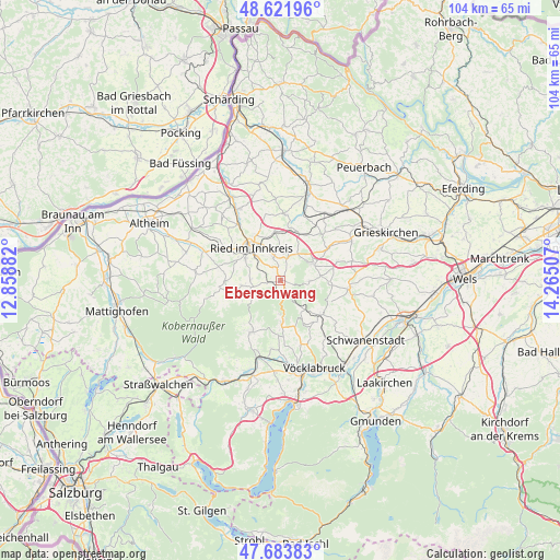
Eberschwang GPS coordinates[2]
48° 9' 18.144" North, 13° 33' 42.984" East
| Map corner | latitude | longitude |
|---|---|---|
| Upper-left | 48.62196°, | 12.85882° |
| Center: | 48.15504°, | 13.56194° |
| Lower-right: | 47.68383°, | 14.26507° |
| Map W x H: | 104.3×104.3 km | = 64.8×64.8mi |
| max Lat: | 48.98333° ⇑24% North |
| Eberschwang: | 48.15504° |
| min Lat: | ⇓76% South 46.48841° |
| min Long | Eberschwang | max Long |
| 9.57802° | 13.56194° | 17.1° |
| W 25.8%⇐ | ⇒74.2% E |
Elevation
Elevation of Eberschwang is 523 m = 1716 ft, and this is 17.5 m = 57 ft above average elevation for this country.
| Max E: |
2140 m = 7021 ft | 39.3% |
| Eberschwang | 523 m 1716 ft | |
| Avg. | 505.5 m = 1658 ft | |
Min E: |
118 m = 387 ft | 60.7% |
See also: Austria elevation on elevation.city.
Geographical zone
Eberschwang is located in North temperate zone (between Tropic of Cancer and the Arctic Circle). Distance of this North polar circle is 2046.8 km =1271.8 mi to North.| Distance of | km | miles | from Eberschwang |
|---|---|---|---|
| North Pole | 4652.7 | 2891.1 | to North |
| Arctic Circle | 2046.8 | 1271.8 | to North |
| Tropic Cancer | 2748.4 | 1707.8 | to South |
| Equator | 5354.3 | 3327 | to South |


Nearby cities:
15 places around Eberschwang: (largest is in red/bold)
• Altenhof am Hausruck
9.3 km =5.8 mi,  105°
105°
• Ampflwang
8 km =5 mi,  177°
177°
• Geboltskirchen
5.3 km =3.3 mi,  91°
91°
• Haag am Hausruck
6.9 km =4.3 mi,  61°
61°
• Maierhof
0.5 km =0.3 mi,  75°
75°
• Neuhofen im Innkreis
7.7 km =4.8 mi,  300°
300°
• Ottnang am Hausruck
9.7 km =6 mi,  132°
132°
• Pattigham
5.7 km =3.5 mi,  270°
270°
• Pram
9.5 km =5.9 mi,  19°
19°
• Pramet
5.7 km =3.5 mi,  256°
256°
• Ried im Innkreis
8.3 km =5.2 mi,  318°
318°
• Schildorn
7.4 km =4.6 mi, 261°
• Siedlung
7.9 km =4.9 mi, 180°
• Wolfsegg am Hausruck
9.8 km =6.1 mi,  123°
123°
• Zell am Pettenfirst
8.8 km =5.5 mi,  161°
161°
Sources, notices
• [Note1] Compared only with cities in Austria existing in our database
• [Src1] Map data: © OpenStreetMap contributors (CC-BY-SA)
• [Src2] Other city data from geonames.org with taken over terms of usage.
• [Src3] Geographical zone / Annual Mean Temperature by Robert A. Rohde @ Wikipedia
